|
 |
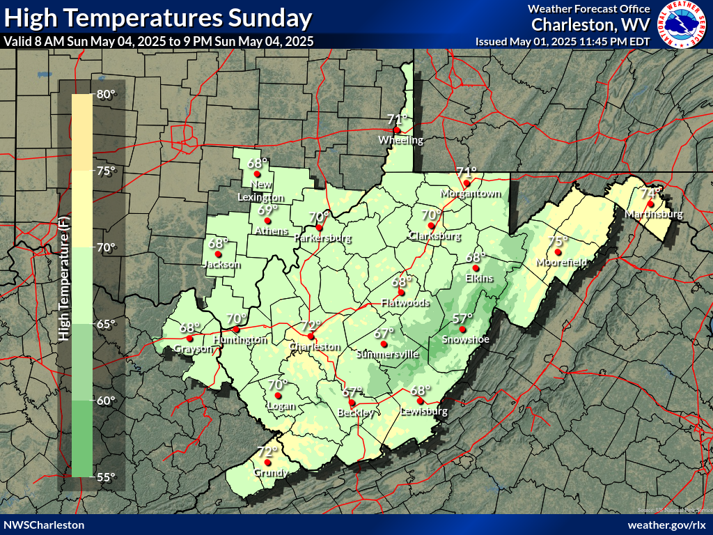
| Clearing. Dense fog develops overnight into Sunday morning. |
| Building high pressure aloft brings drier air to the area tonight. Mostly clear skies, near calm winds, and antecedent precipitation will allow for widespread dense fog formation, mainly along river valleys tonight into Sunday morning. Drier weather will take hold for much of the area Sunday, outside of a few afternoon and evening showers or thunderstorms in the mountains and foothills, as a ridge of high pressure builds in. Dry weather should last into Tuesday night. It will become increasingly hot from Monday through midweek. Another system moves into the region mid week, with additional rounds of storms. Get additional details in our Area Forecast Discussion... |
|
Latest Emergency Manager's Briefing (pdf) Updated: 9:03 AM EST Fri May 17 This briefing is updated each Monday and Friday, and more frequently during hazardous weather events. |
Weather Hazards Outlook
|
Highlighted Hazard
|
7 Day Total Hazards
|
 |
 |
| Pittsburgh | Sterling | Blacksburg | |
|
388 FLUS41 KRLX 180613 HWORLX Hazardous Weather Outlook National Weather Service Charleston WV 213 AM EDT Sat May 18 2024 KYZ101>103-105-OHZ066-067-075-076-083>087-VAZ003-004-WVZ005>011- 013>020-024>034-039-040-515>526-190615- Greenup-Carter-Boyd-Lawrence KY-Perry-Morgan-Athens-Washington- Jackson OH-Vinton-Meigs-Gallia-Lawrence OH-Dickenson-Buchanan-Wayne- Cabell-Mason-Jackson WV-Wood-Pleasants-Tyler-Lincoln-Putnam-Kanawha- Roane-Wirt-Calhoun-Ritchie-Doddridge-Mingo-Logan-Boone-Clay-Braxton- Gilmer-Lewis-Harrison-Taylor-McDowell-Wyoming-Upshur-Barbour- Northwest Raleigh-Southeast Raleigh-Northwest Fayette- Southeast Fayette-Northwest Nicholas-Southeast Nicholas- Northwest Webster-Southeast Webster-Northwest Pocahontas- Southeast Pocahontas-Northwest Randolph-Southeast Randolph- 213 AM EDT Sat May 18 2024 This Hazardous Weather Outlook is for northeast Kentucky, southeast Ohio, southwest Virginia and much of West Virginia. .DAY ONE...Today and Tonight. Showers and thunderstorms remain possible today. Localized flash flooding is possible. .DAYS TWO THROUGH SEVEN...Sunday through Friday. No hazardous weather is expected at this time. .SPOTTER INFORMATION STATEMENT... Weather spotters are encouraged to report significant weather conditions by calling the toll-free spotter hotline, or by other methods detailed at www.weather.gov/rlx/reports. $$ |
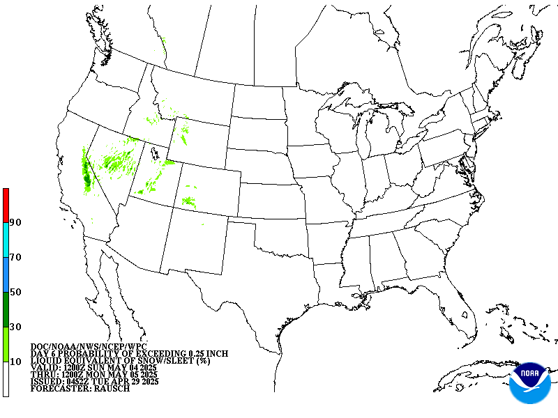
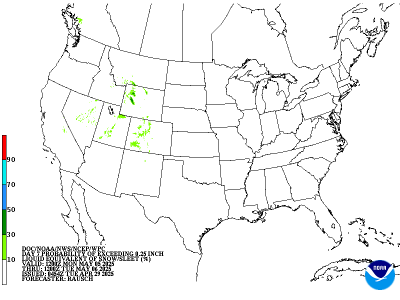
| Days 1-3 Total Rain, Snow & Ice |
 |
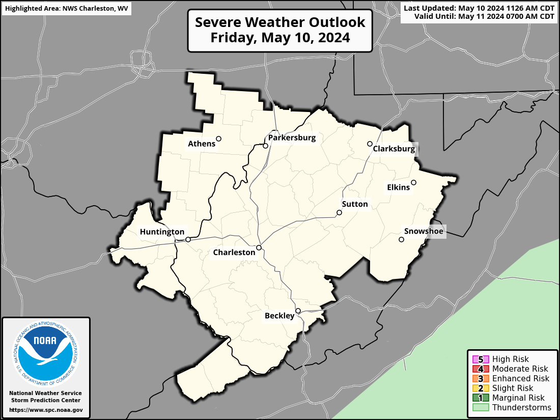
| Days 1-8 Severe Weather Outlooks |
 |
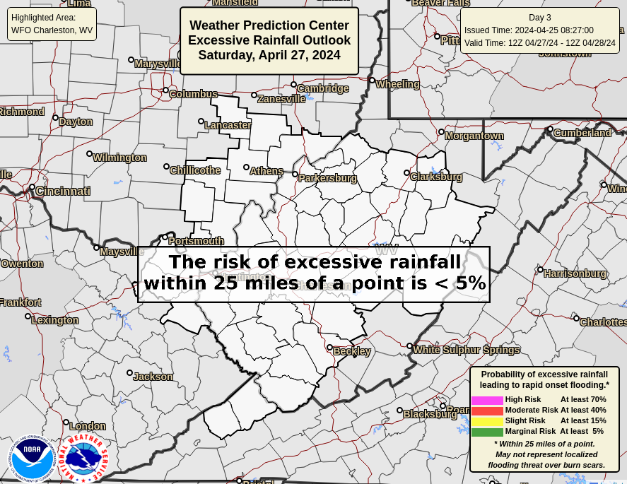
| Days 1-3 Excessive Rainfall Outlooks |
 |
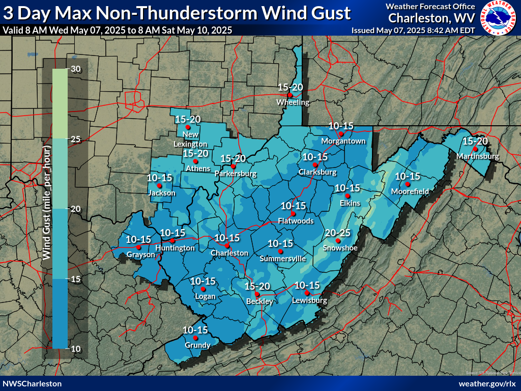
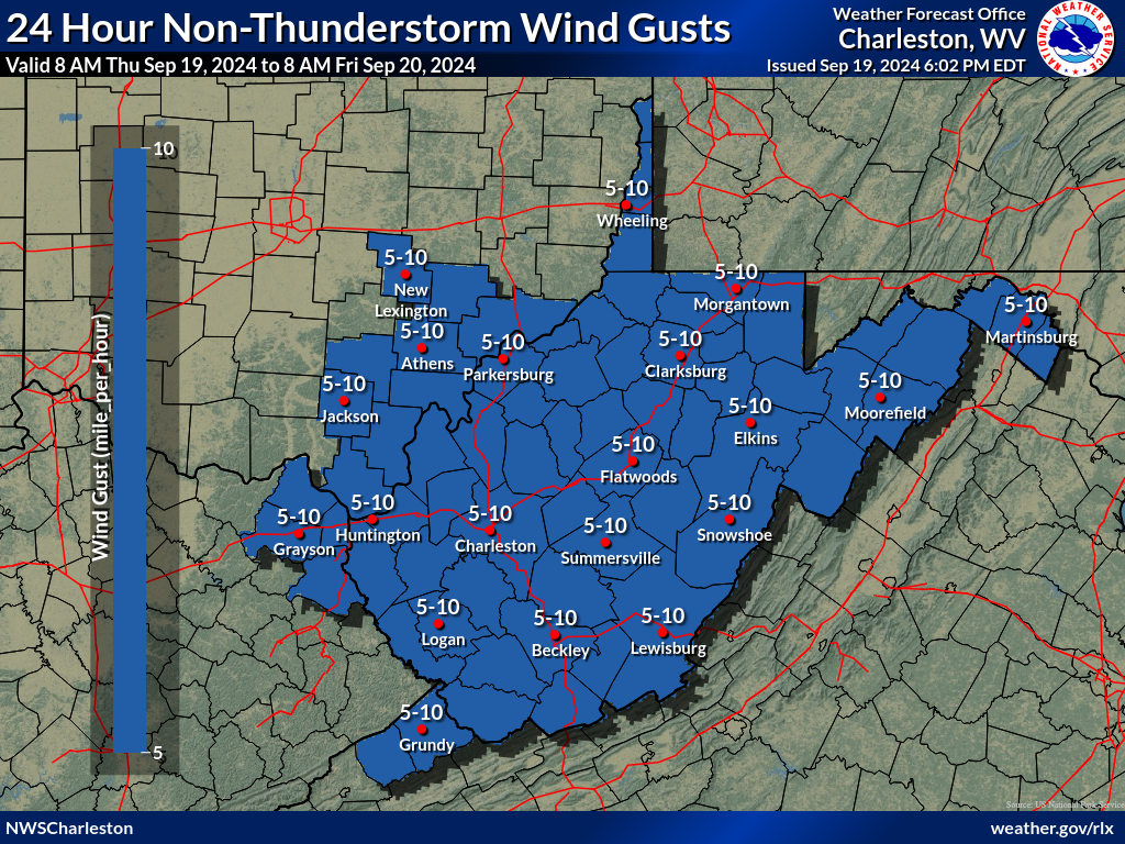
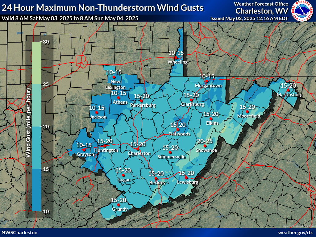
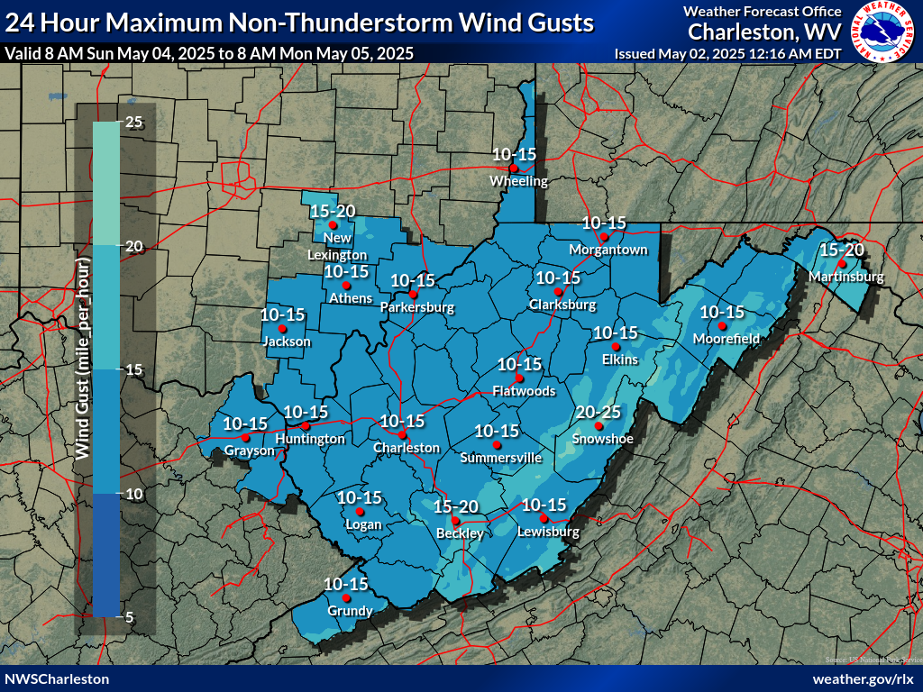
| Days 1-3 Maximum Non-TS Wind Gusts |
 |
Observed Weather Briefing
 |
 Regional Radar Loop |
 NWS Charleston, WV Radar Loop |
 Jackson, KY |
 Wilmington, OH |
 Pittsburgh, PA |
 Sterling, VA |
 Blacksburg, VA |
 Morristown, TN |
||
| Click Here for Interactive Radar Display | ||||
 GeoColor Satellite Image |
 Infrared Satellite Image Infrared Satellite Image |
 Water Vapor Image |
| Additional Satellite Imagery |
 US Surface Analysis |
 US Surface Analysis with Radar |
 US Surface Temps | N America | World |
| Hourly Weather Roundups | Regional Temp/Precip Summaries | Miscellaneous Links |
| West Virginia | Supplemental Obs | West Virginia | COOPs | CoCoRaHS | Rain Gauge Monitor |
| East Kentucky | East KY | Hourly Rainfall | IFLOWS WV | KY | OH | VA |
| Ohio | Ohio | Srn Ohio | COOPs | CoCoRaHS WV | KY | OH | VA |
| Pennsylvania | Pennsylvania Wrn COOPs | Cntl COOPs |
Road Conditions WV | KY | OH | VA |
| Maryland & DC Area | Maryland & DC Area | COOPs | Kentucky Mesonet |
| Virginia | Virginia | COOPs | National Precip | Snowfall |
Rainfall and Flood Threat Briefing
| How Much Rain Has Fallen? (Interactive) | |
 |
 |
| Flash Flood Guidance |
Flash Flood Guidance (FFG) provides a general indication of the amount of rainfall evenly distributed over various durations (in hours), necessary to cause small streams to overflow their natural banks. During heavy rainfall, accurate interpretation of the guidance consists of the combination of rainfall that has already occurred plus any additional rainfall that can be confidently expected to fall over the same location in the immediate future.
It should be noted that FFG values represent estimates of average soil moisture and stream flow conditions. Flooding may occur with less rainfall than indicated in areas of high rainfall intensities, impervious surfaces, or steep slopes.
| 1 Hour | 3 Hour | 6 Hour |
 |
 |
 |
| Precipitation Forecasts | |||
| Today's Precip Forecast | Tomorrow's Precip Forecast | Day 3 Precip Forecast | Day 1 - 3 Total Precip Forecast |
 |
 |
 |
 |
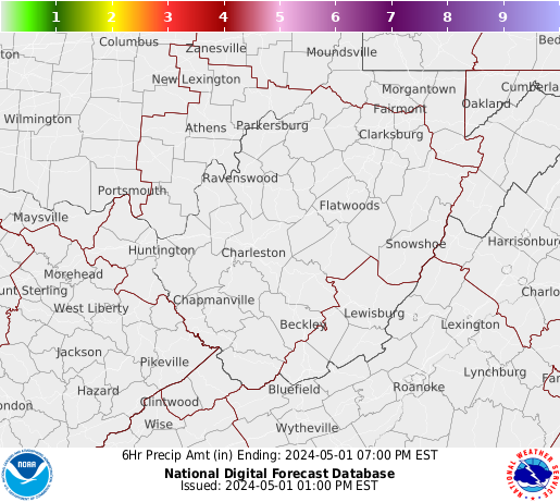
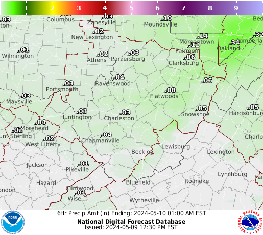
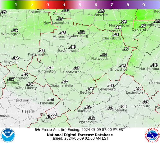
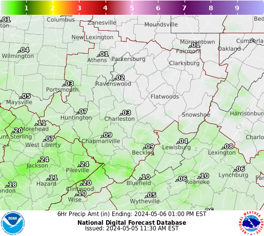
| 0 to 6 hours | 6 to 12 hours | 12 to 18 hours | 18 to 24 hours | 24 to 30 hours | 30 to 36 hours | |
 |
 |
 |
 |
 |
 |
 |
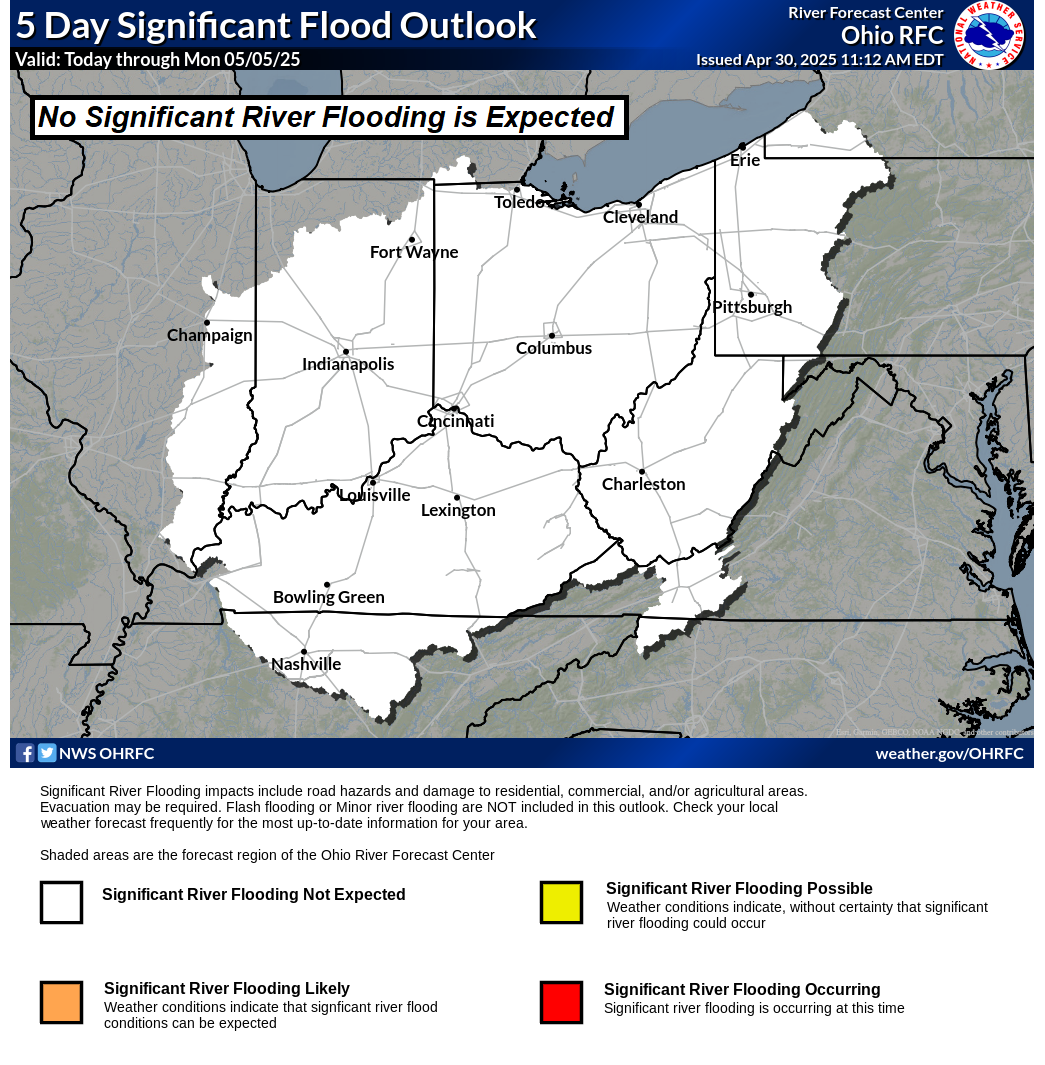
| Day 1 Excessive Rainfall Outlook | Day 2 Excessive Rainfall Outlook | Day 3 Excessive Rainfall Outlook | Ohio River Basin Flood Outlook |
 |
 |
 |
 |
| Day 1 Precipitation | Day 2 Precipitation | Day 3 Precipitation |
 |
 |
 |
| Day 4-5 Precipitation | Day 6-7 Precipitation | 7-Day Total Precipitation |
 |
 |
 |
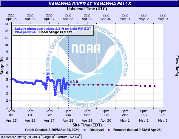
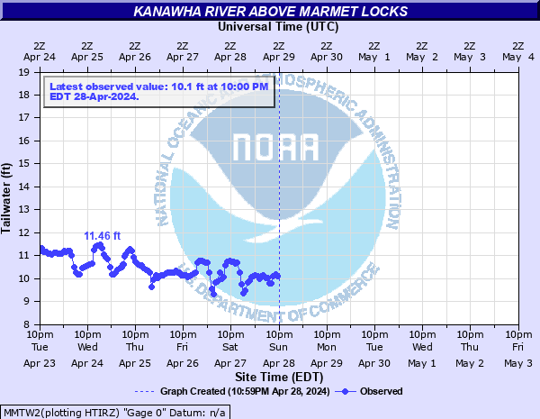
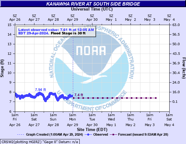
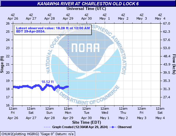
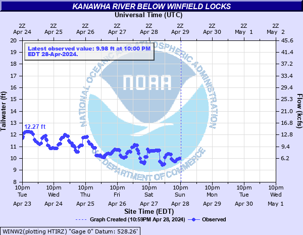
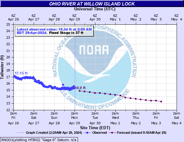
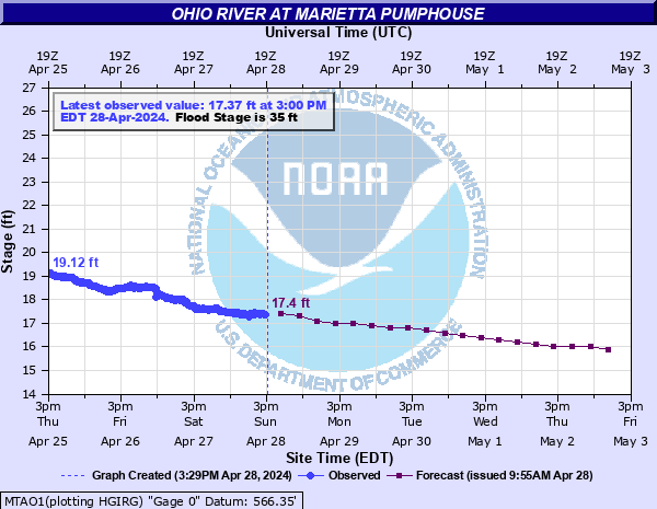
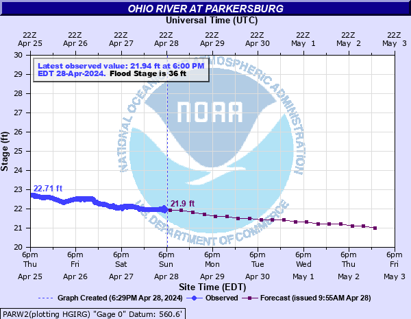
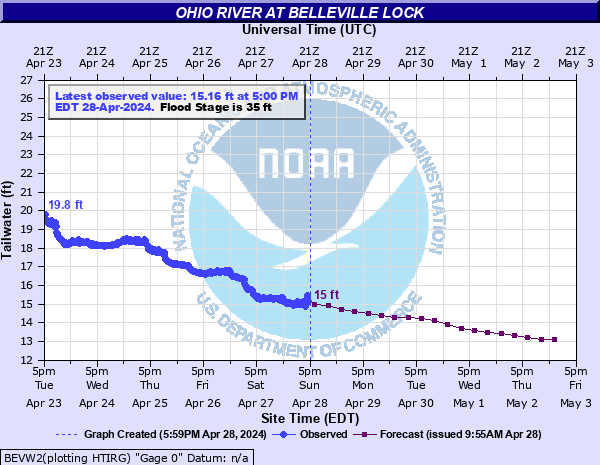
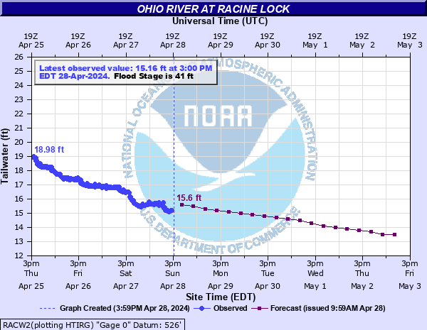
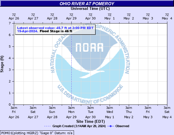
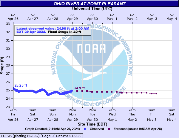
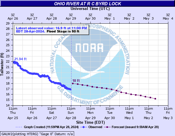
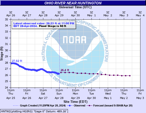
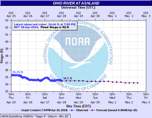
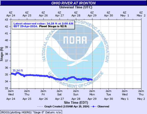
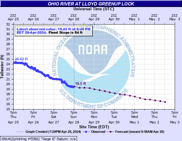
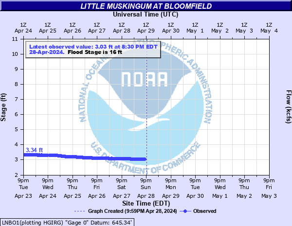
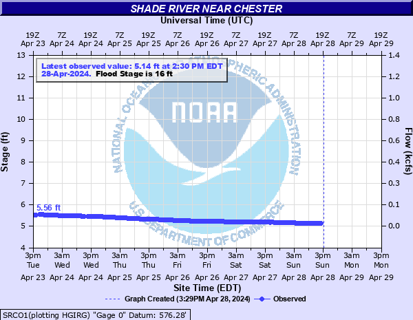
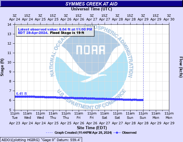
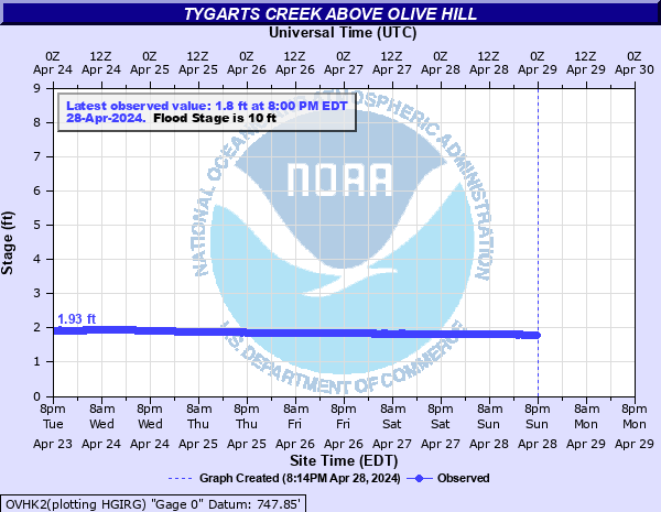
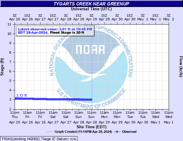
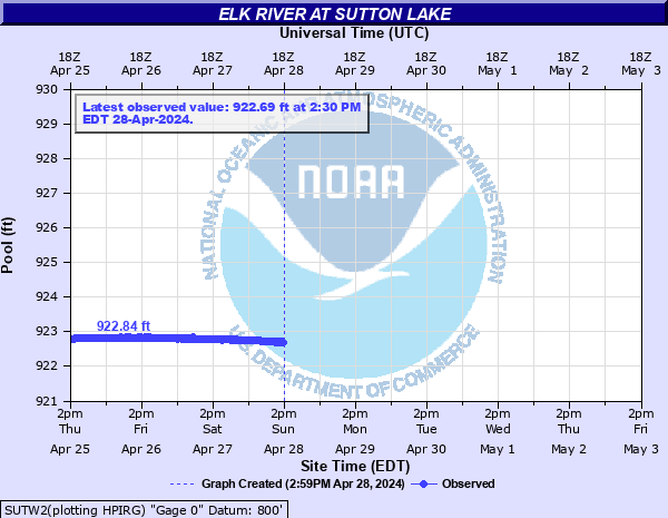
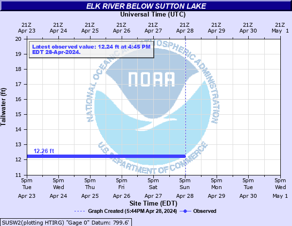
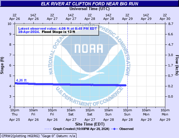
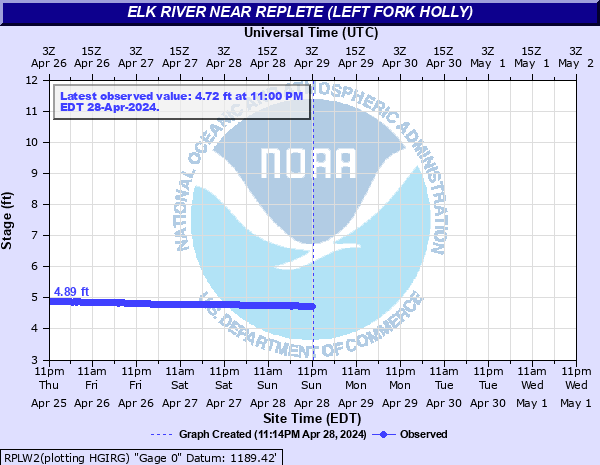
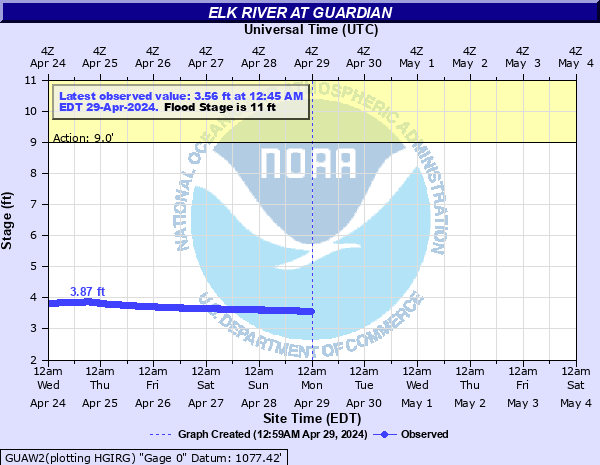
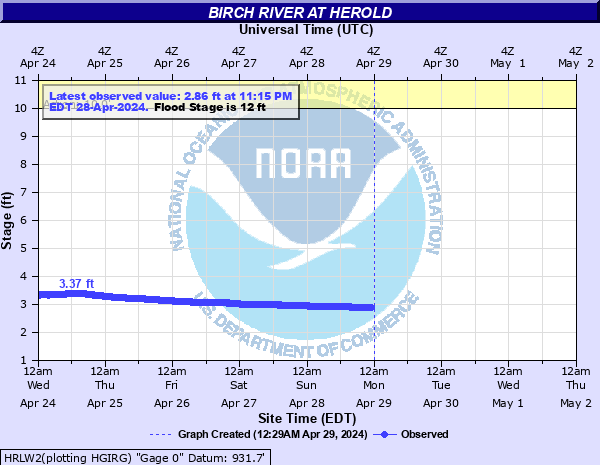
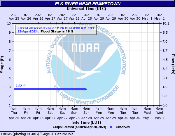
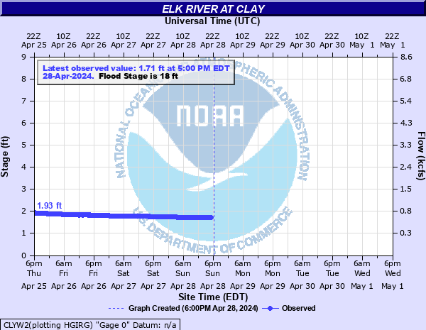
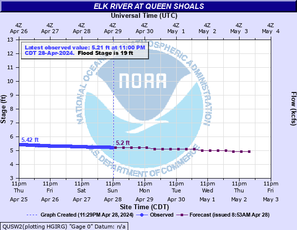
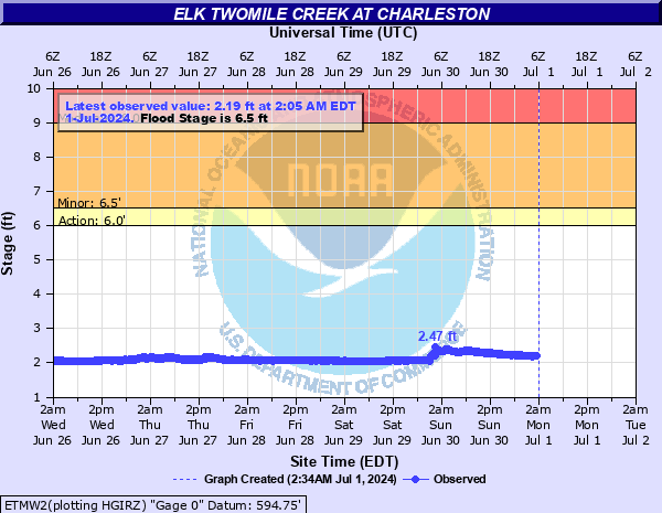
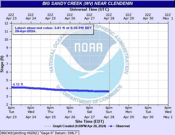
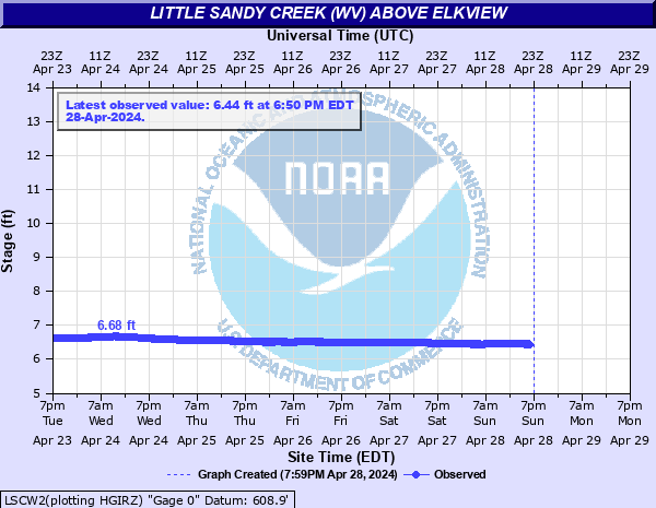
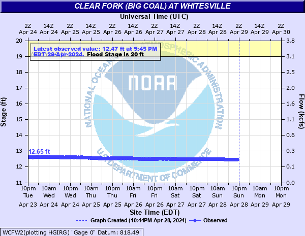
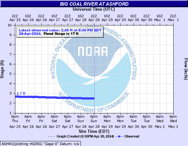
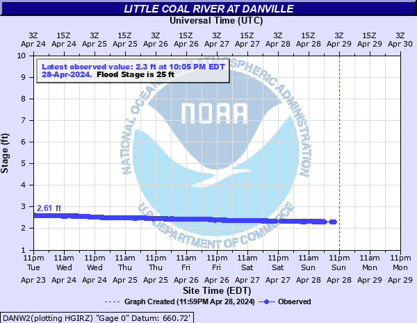
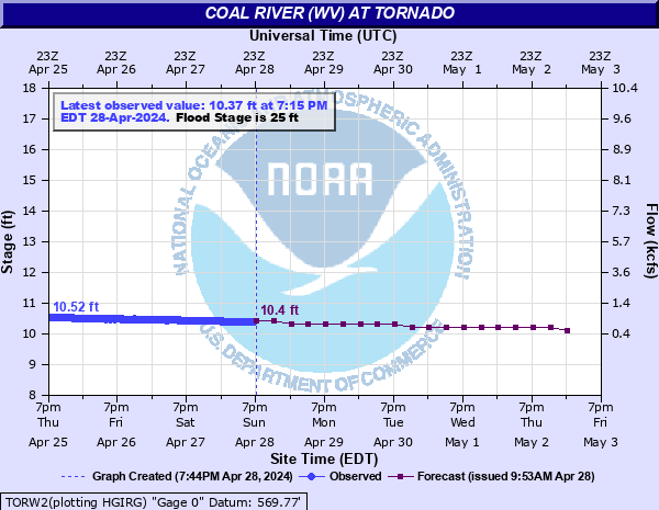
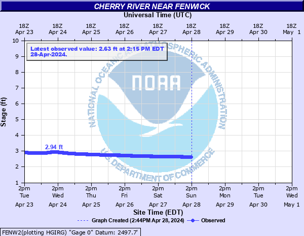
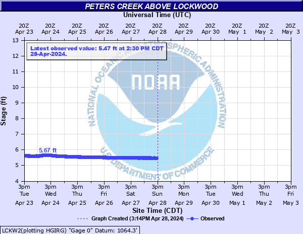
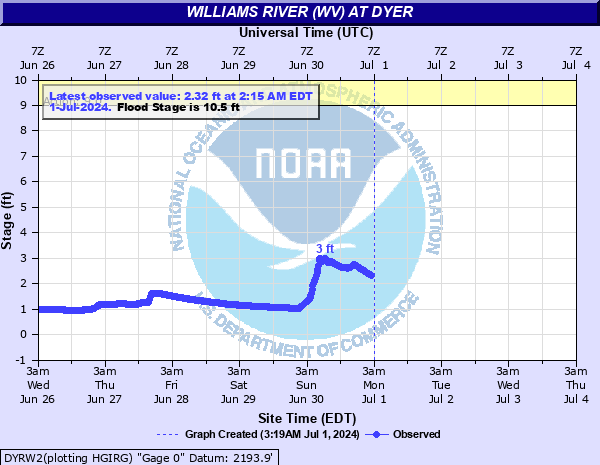
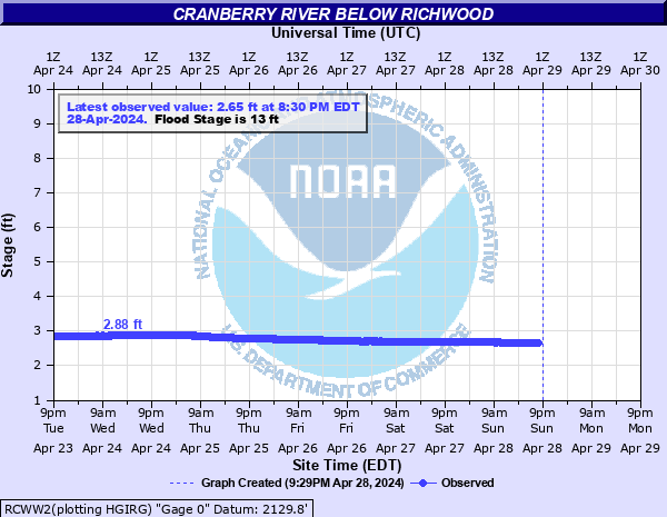
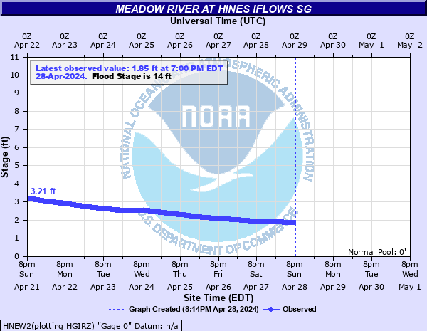
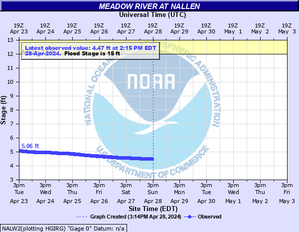
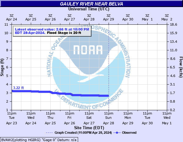
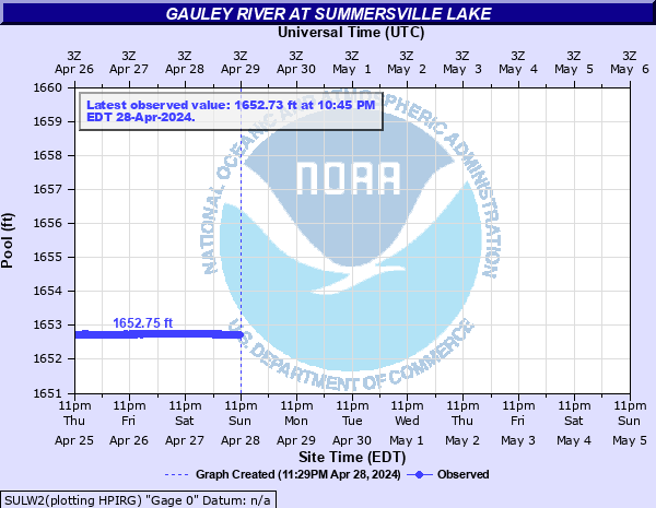
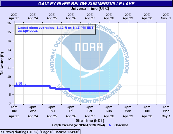
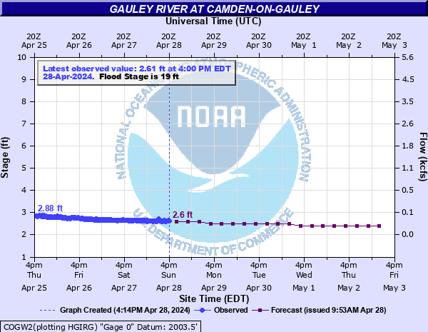
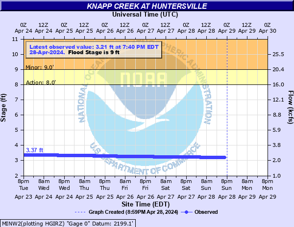
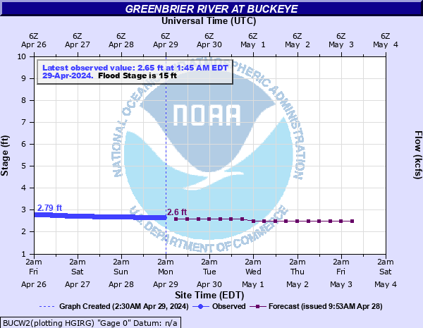
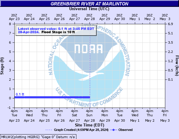
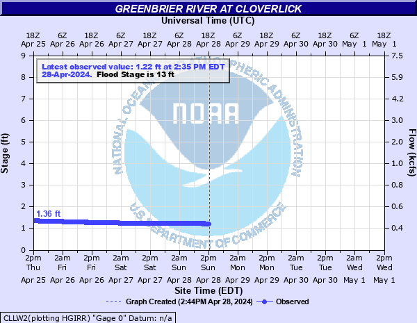
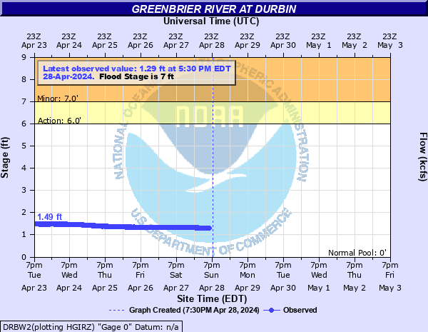
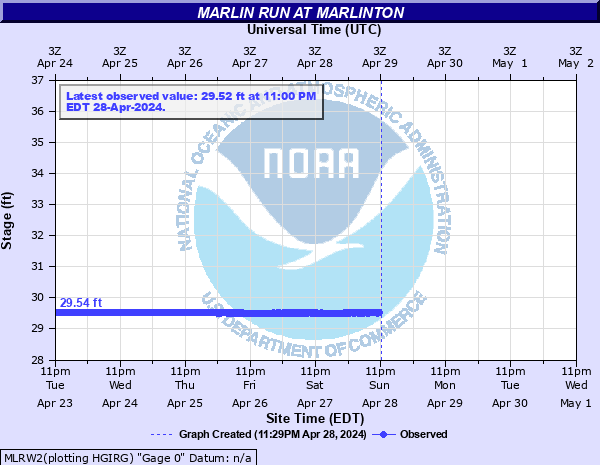
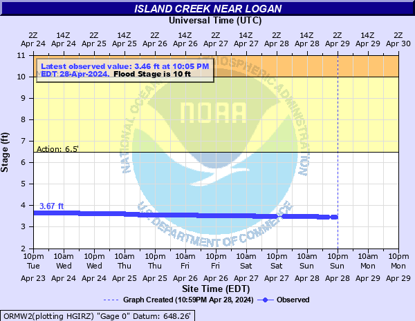
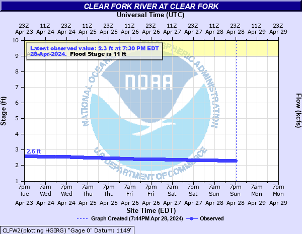
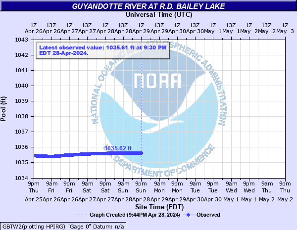
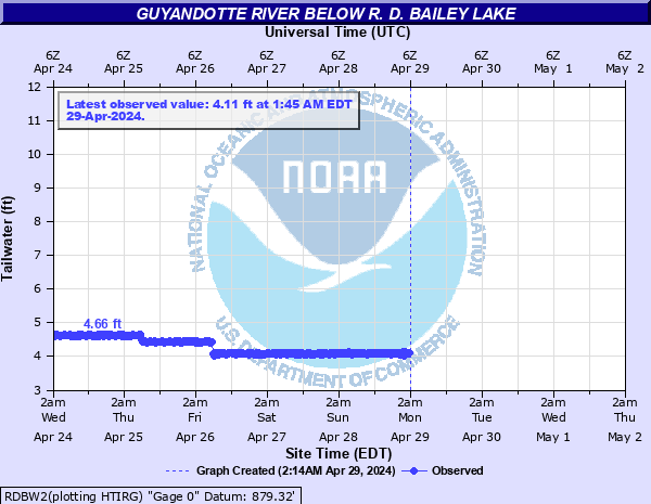
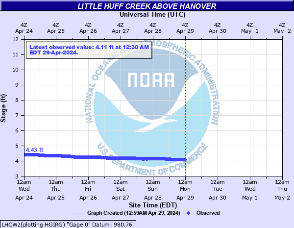
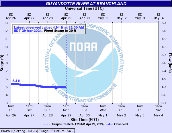
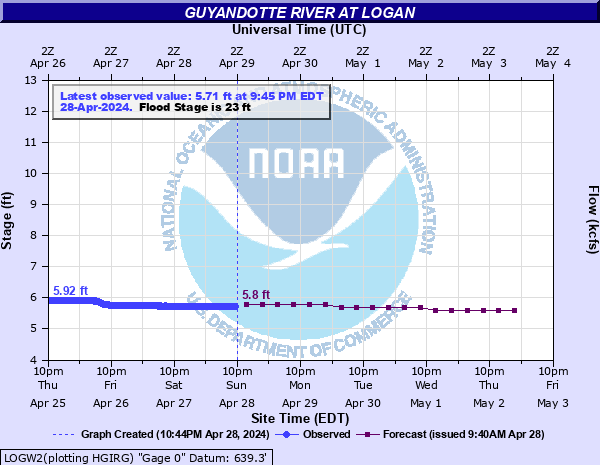
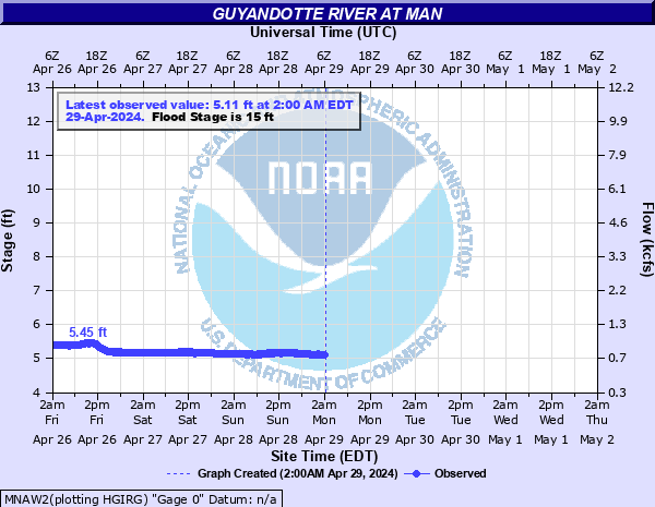
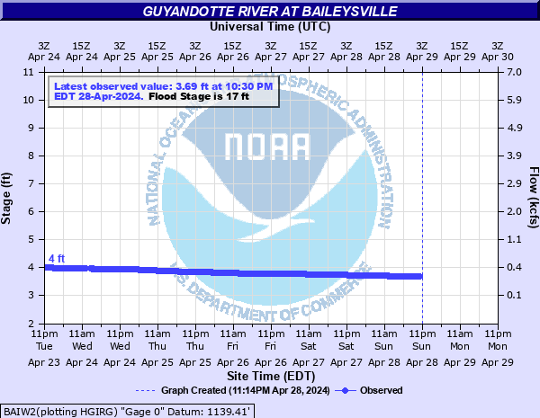
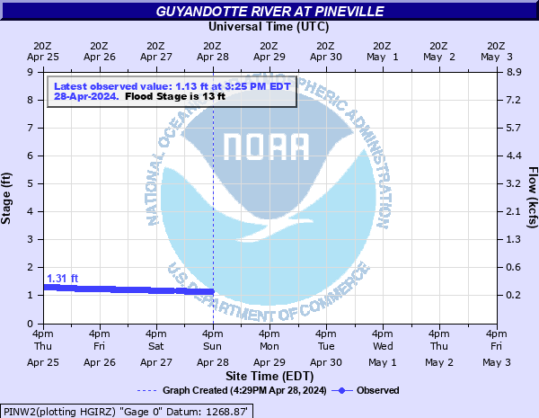
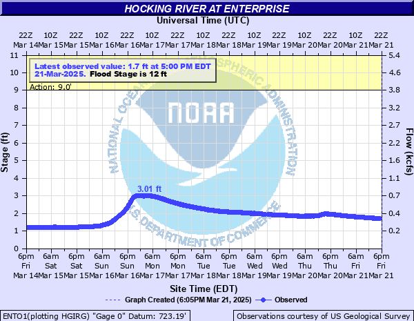
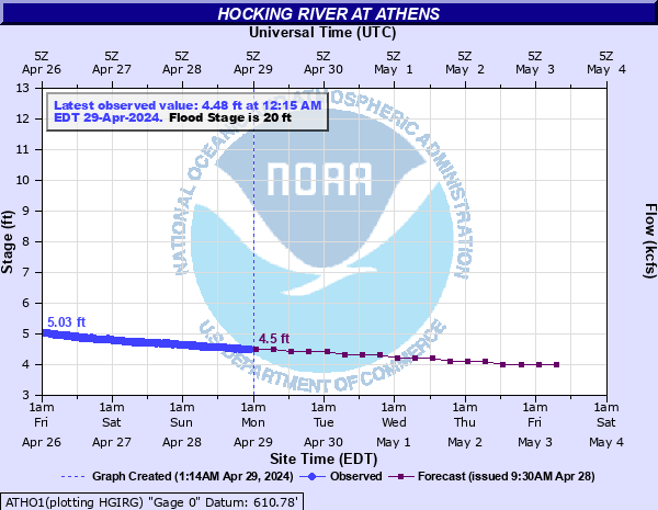
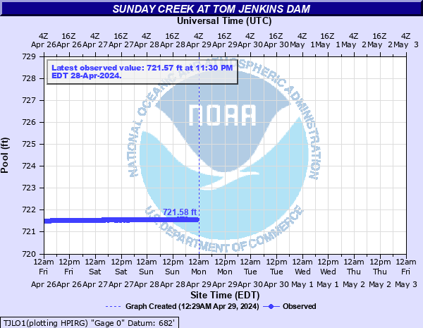
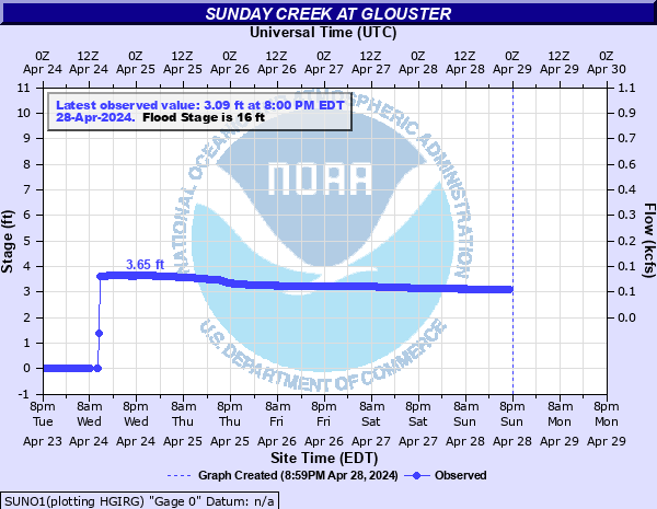
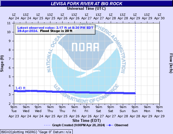
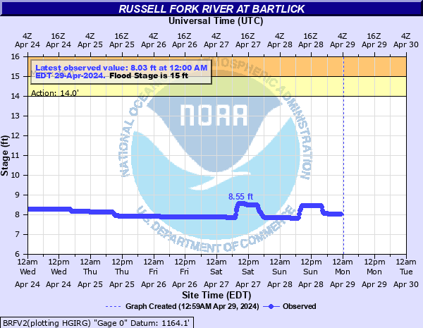
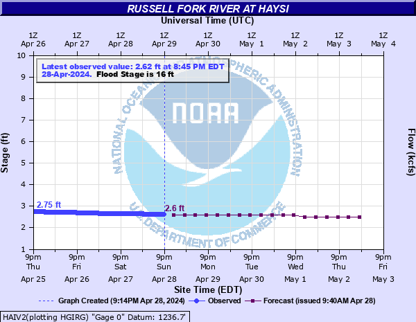
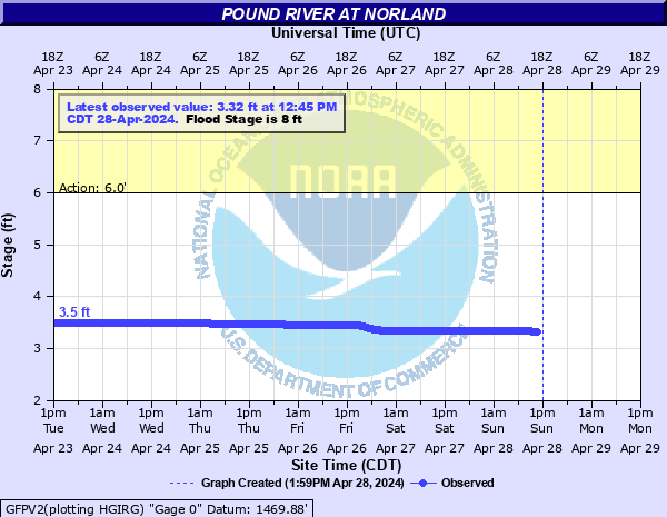
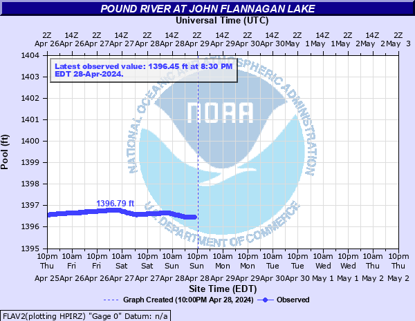
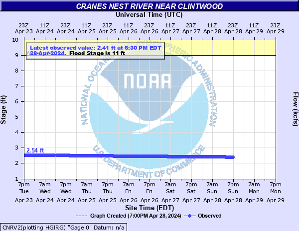
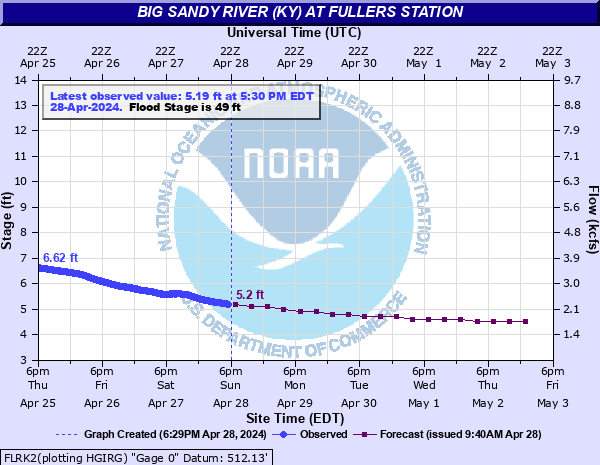
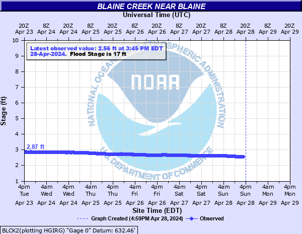
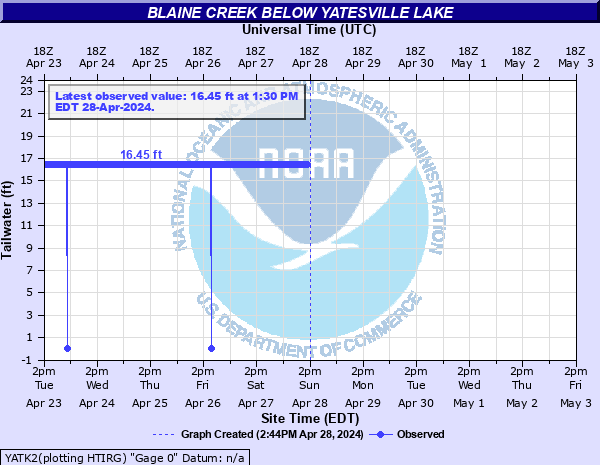
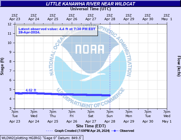
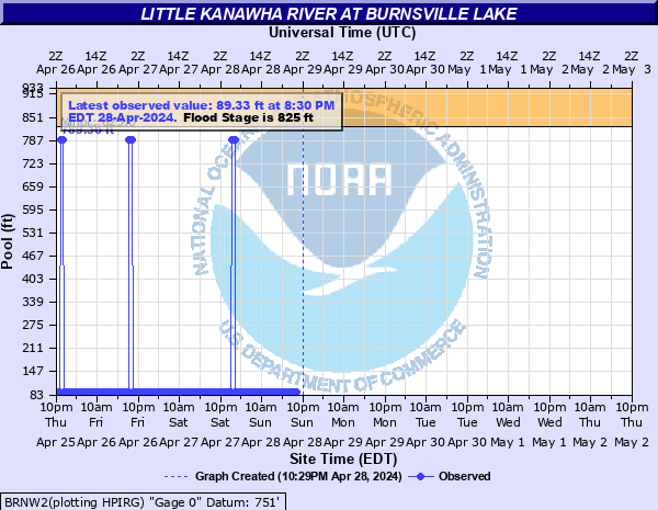
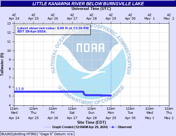
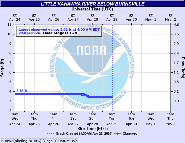
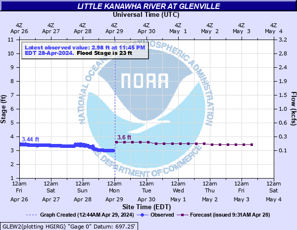
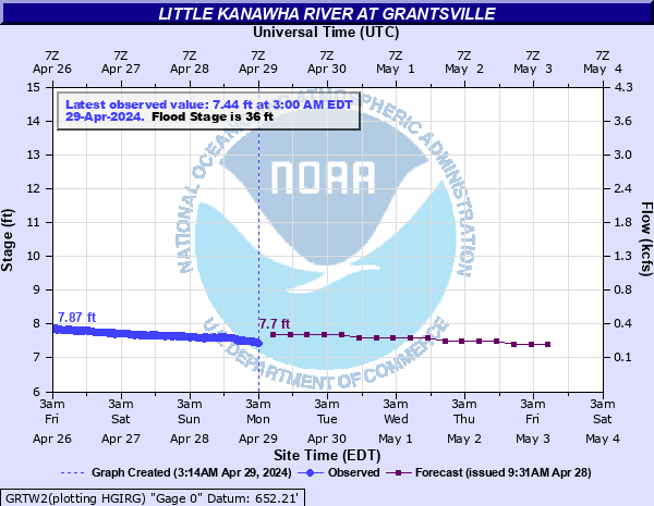
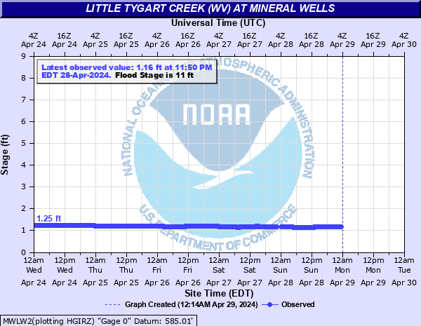
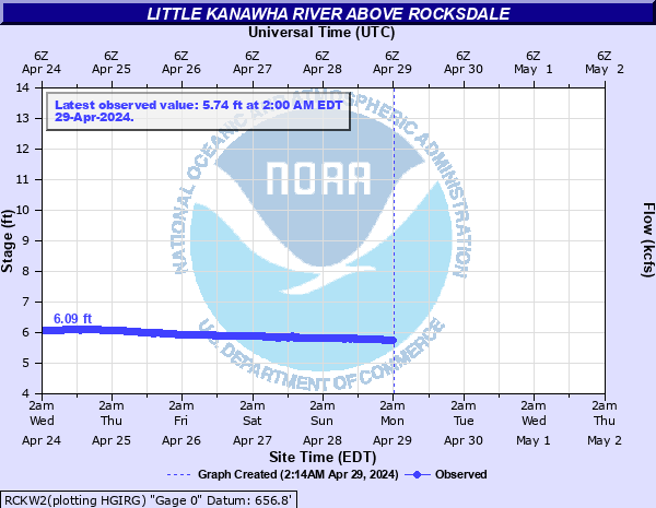
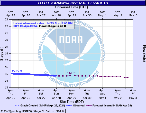
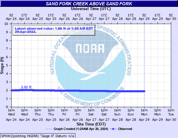
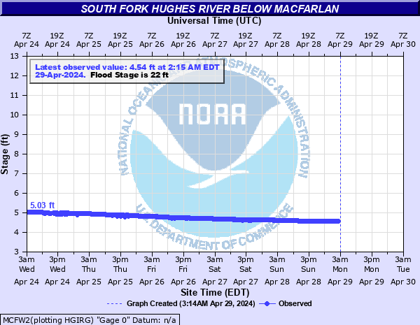
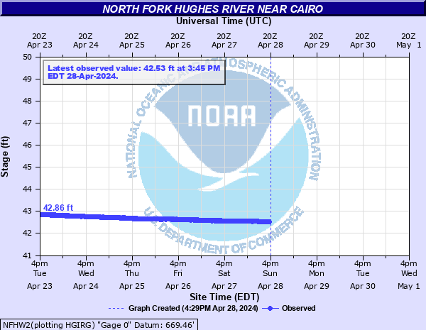
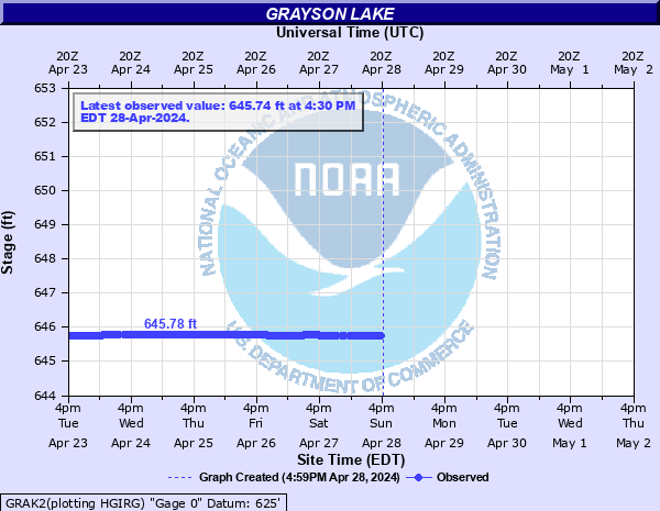
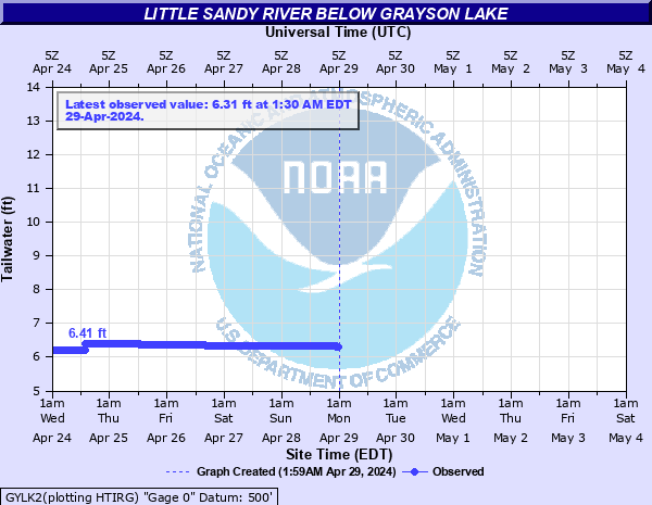
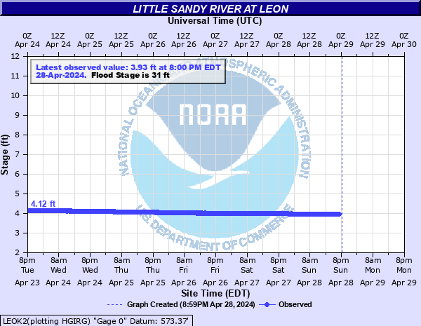
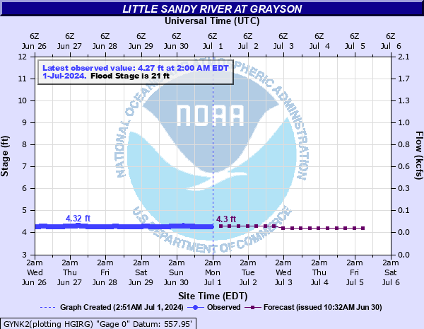
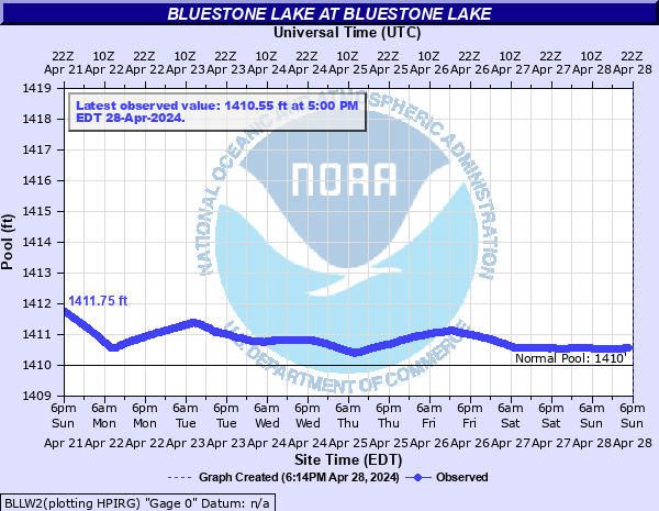
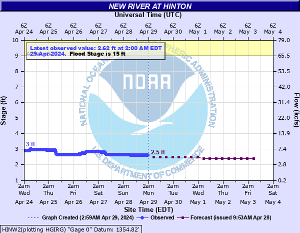
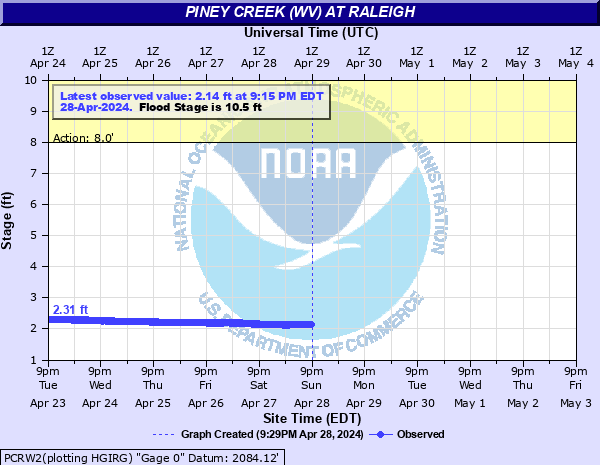
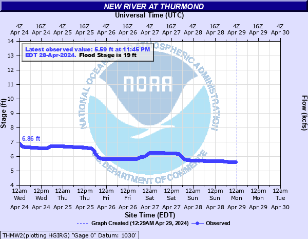
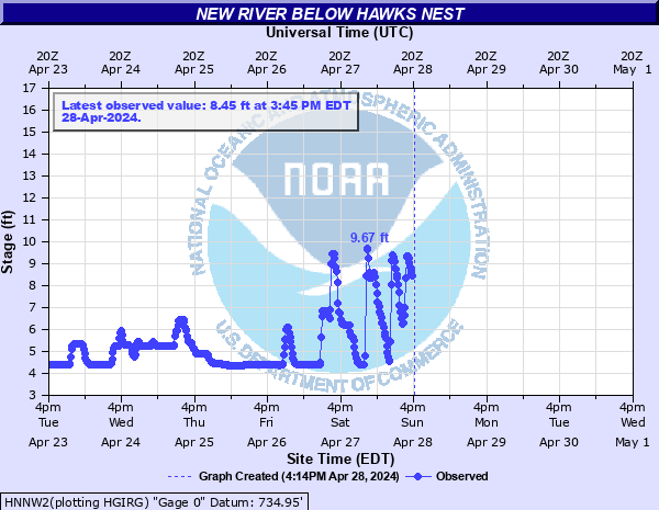
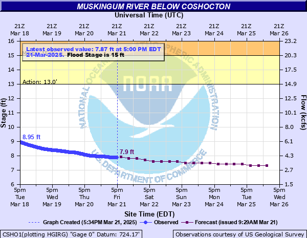
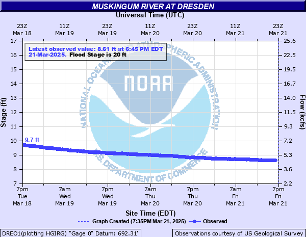
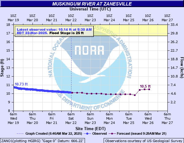
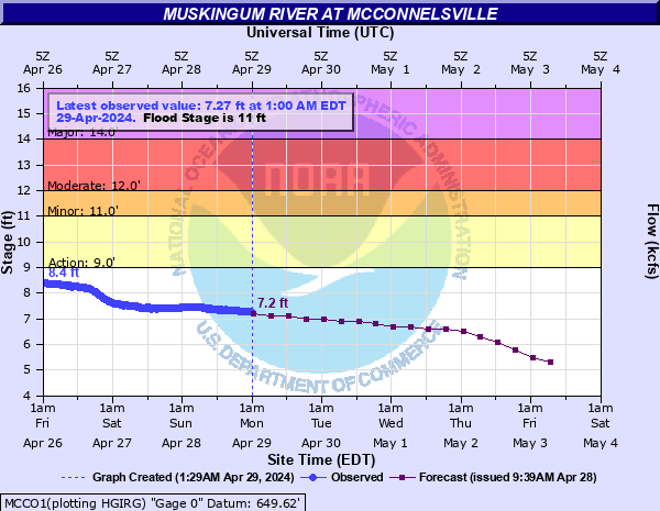
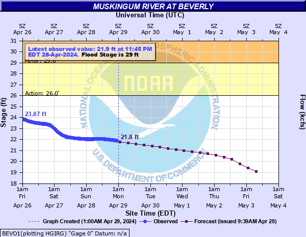
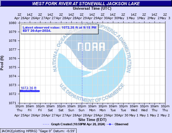
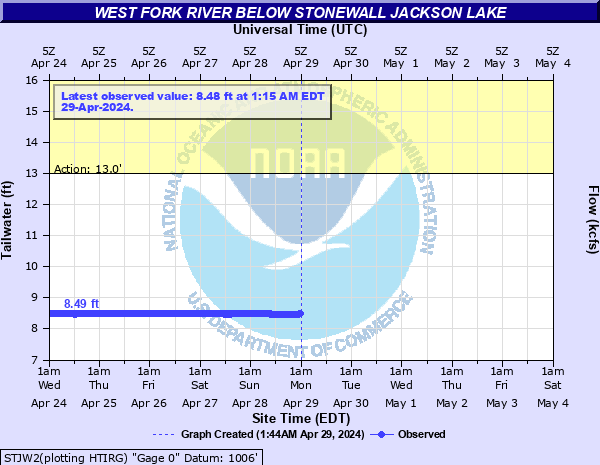
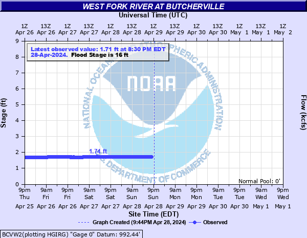
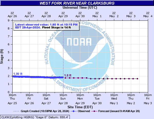
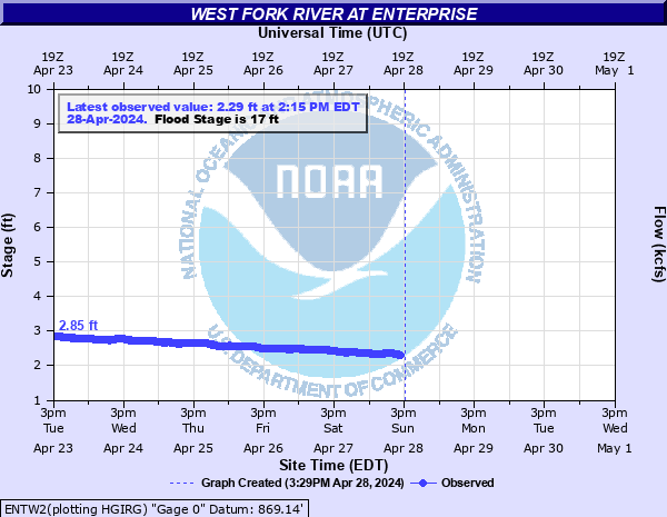
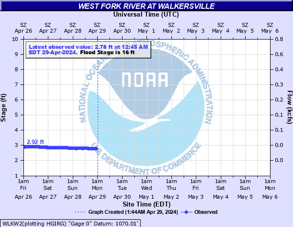
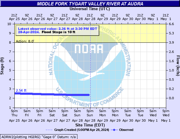
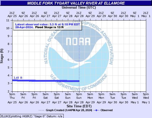
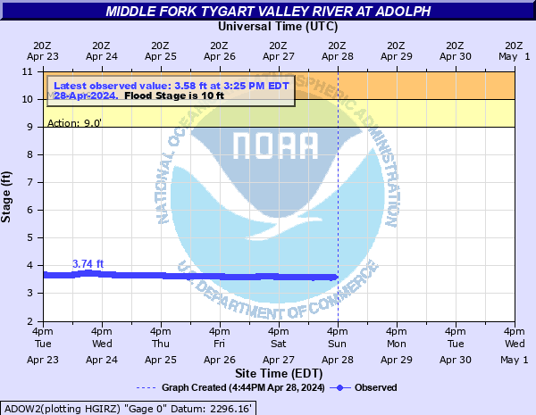
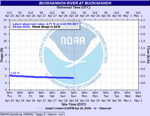
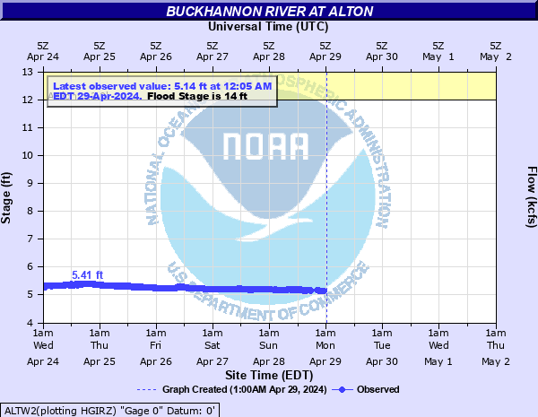
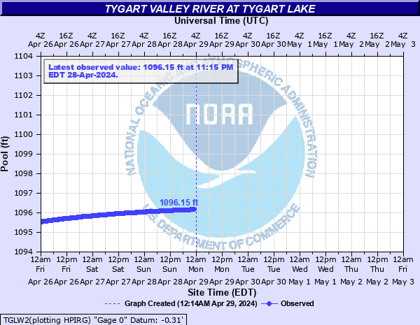
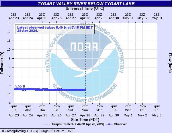
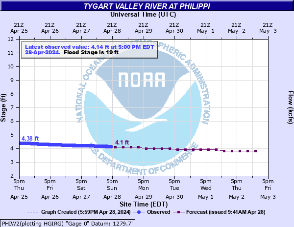
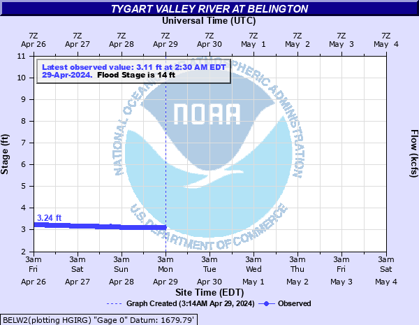
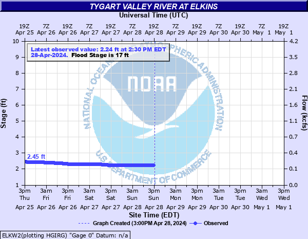
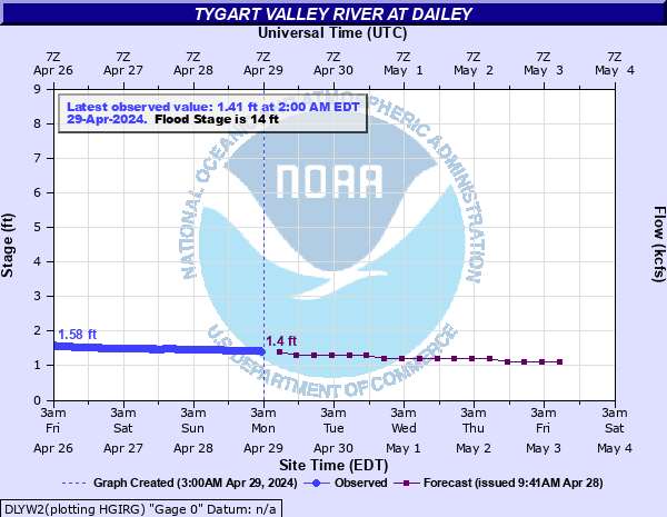
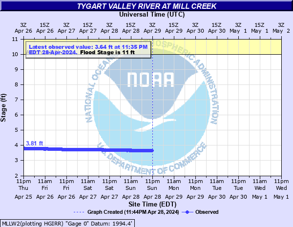
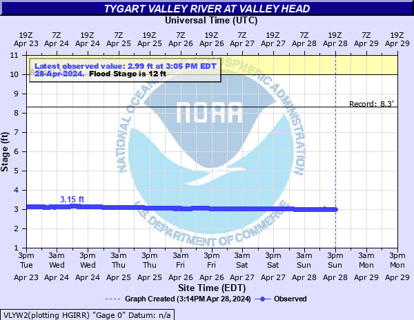
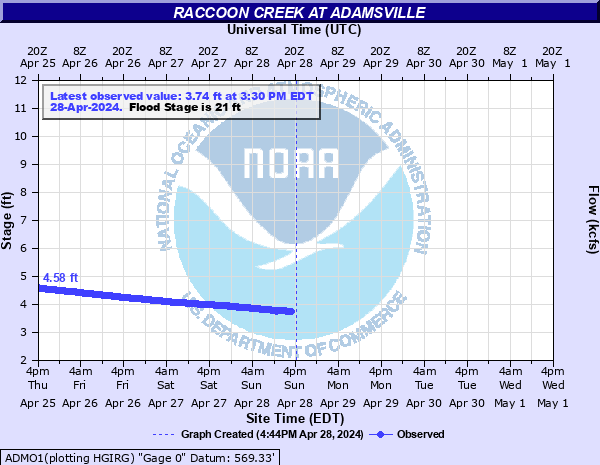
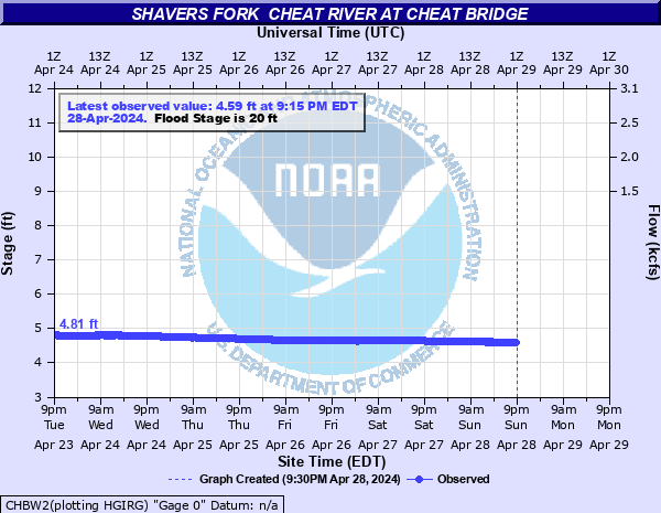
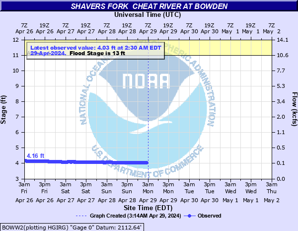
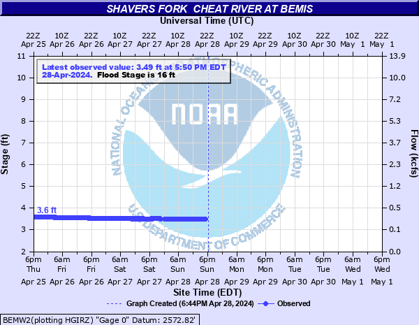
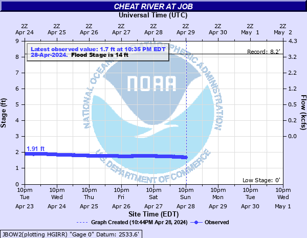
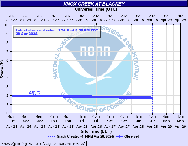
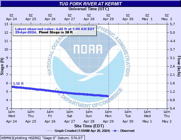
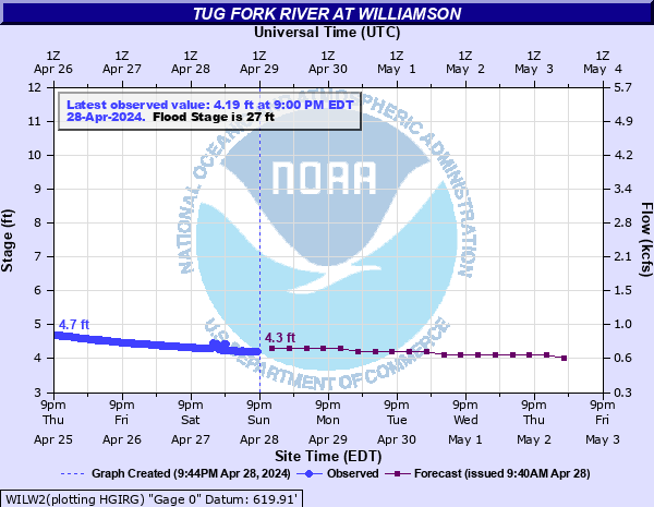
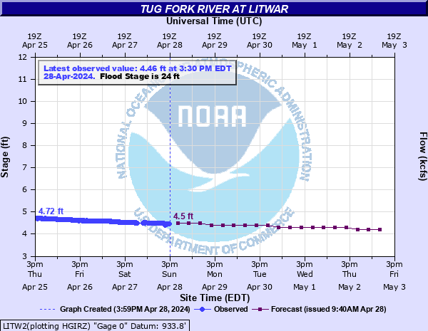
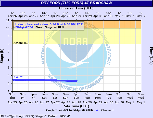
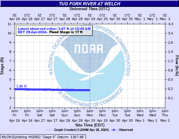
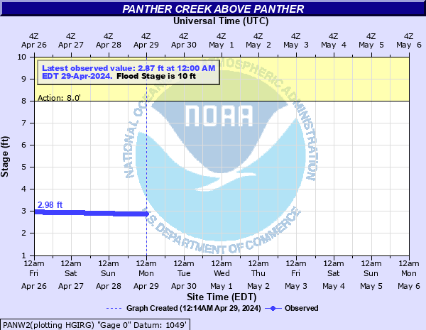
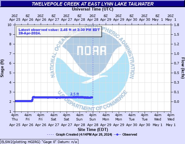
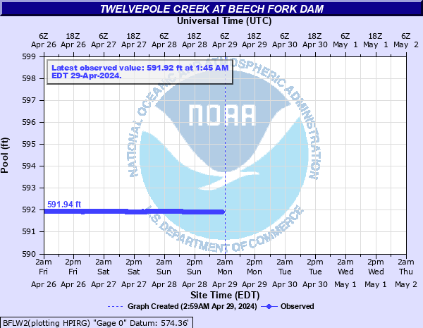
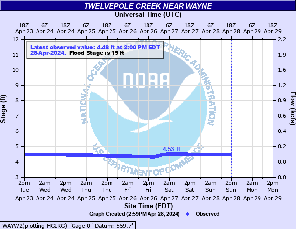
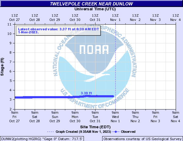
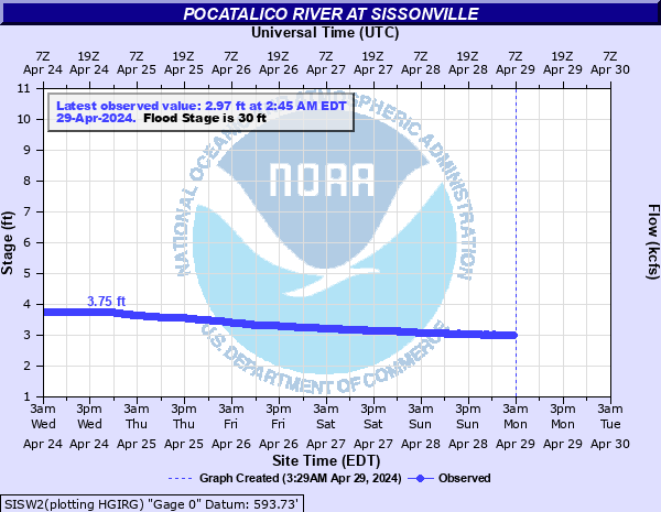
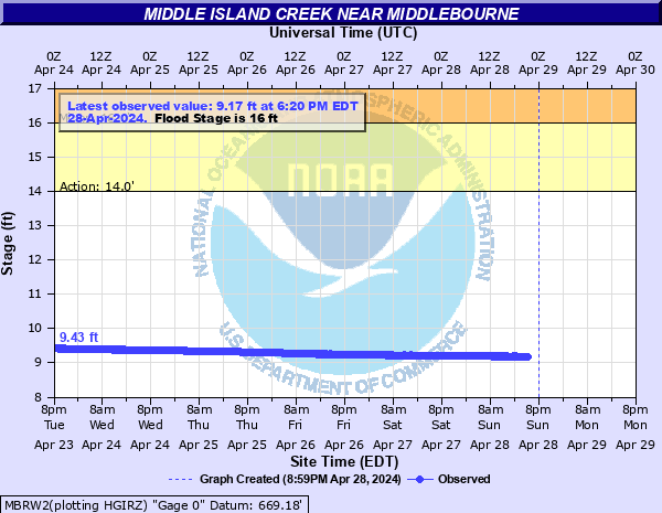
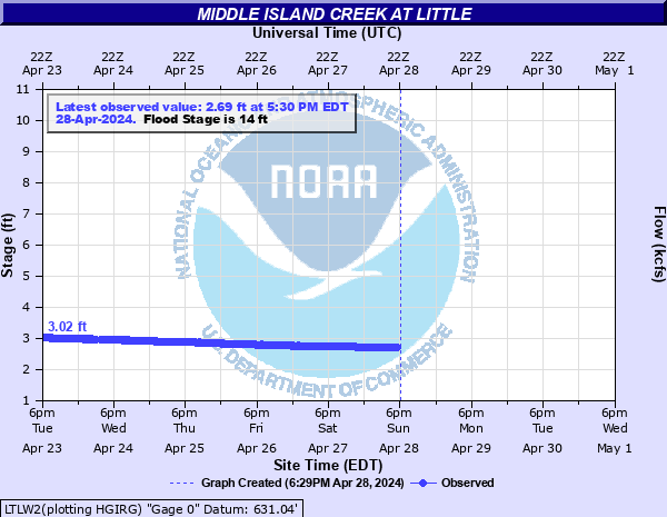
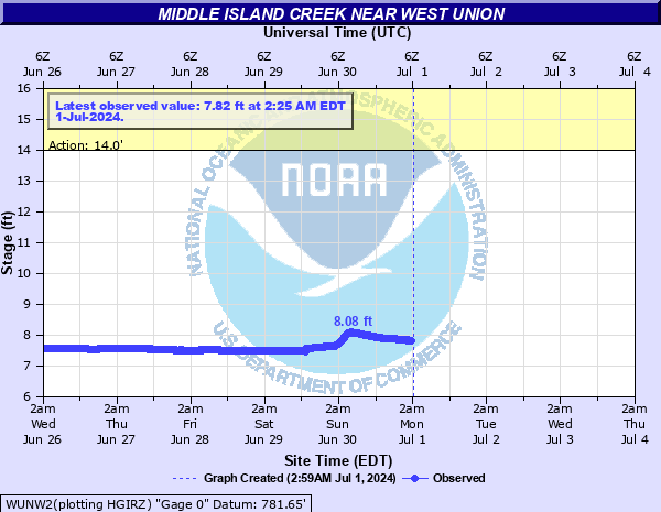
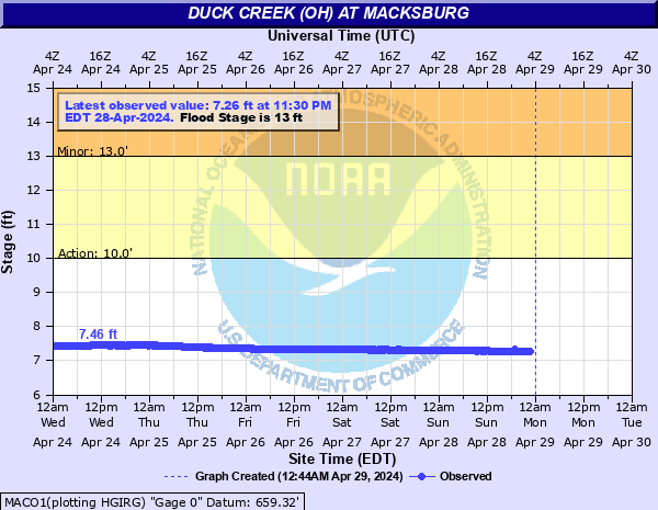
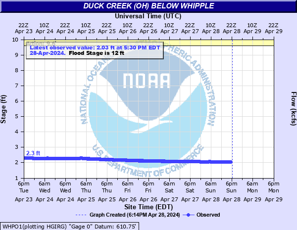
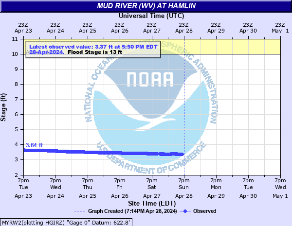
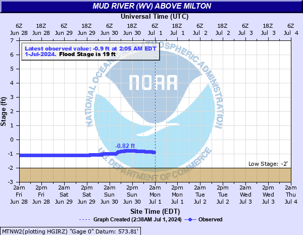
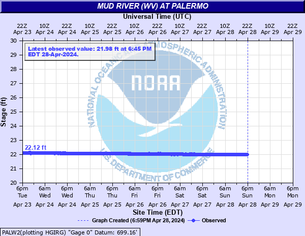
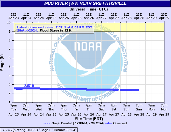
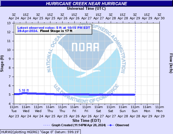
Hydrographs (showing stages and flows over time) are available through the Advanced Hydrologic Prediction Service (AHPS) by clicking site names.
|
|||||||||||||||||||||||||||||||||||||||||||||||||||||||||||||||||||||||||||||||||||||||||||||||||||||||||||||||||||||||||||||||||||||||||||||||||||||||||||||||||||||||||||||||||||||||||||||||||||||||||||||||||||||||||||||||||||||||||||||||||||||||||||||||||||||||||||||||||||||||||||||||||||||||||||||||||||||||||||||||||||||||||||||||||||||||||||||||||||||||||||||||||||||||||||||||||||||||||||||||||||||||||||||||||||||||||||||||||||||||||||||||||||||||||||||||||||||||||||||||||||||||||||||||||||||||||||||||||||||||||||||||||||||||||||||||||||||||||||||||||||||||||||||||||||||||||||||||||||||||||||||||||||||||||||||||||||||||||||||||||||||||||||||||||||||||||||||||||||||||||||||||||||||||||||||||||||||||||||||||||||||||||||||||||||||||||||||||||||||||||||||||||||||||||||||||||||||||||||||||||||||||||||||||||||||||||||||||||||||||||||||||||||||||||||||||||||||||||||||||||||||||||||||||||||||||||||||||||||||||||||||||||||||||||||||||||||||||||||||||||||||||||||||||||||||||||||||||||||||||
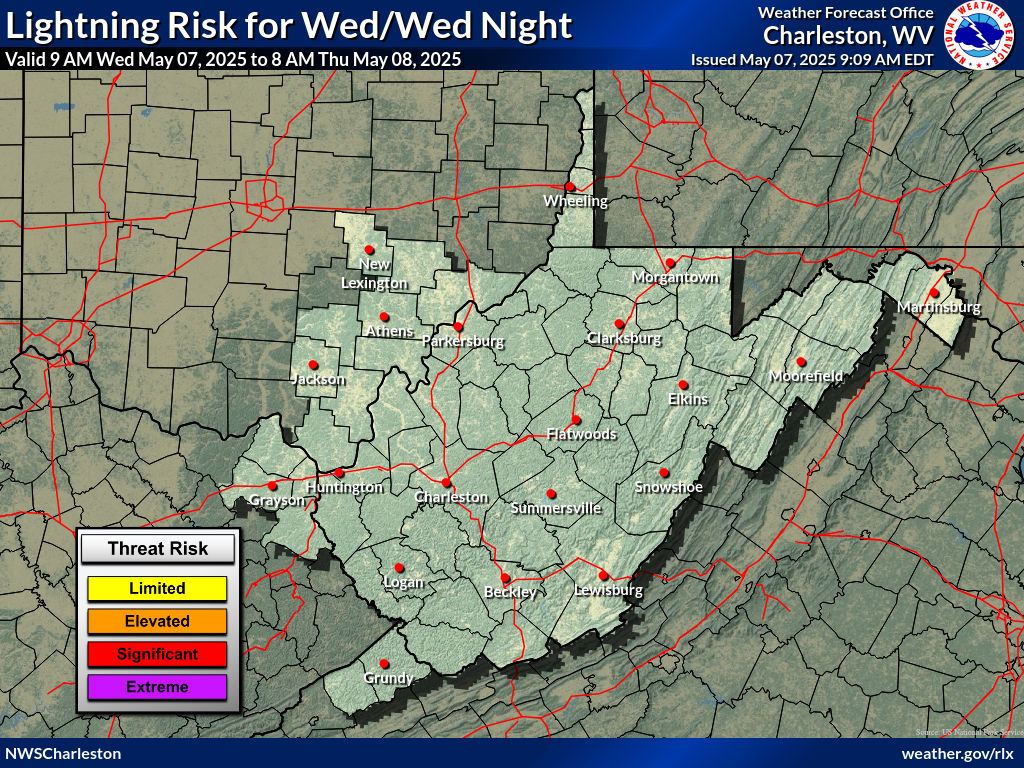
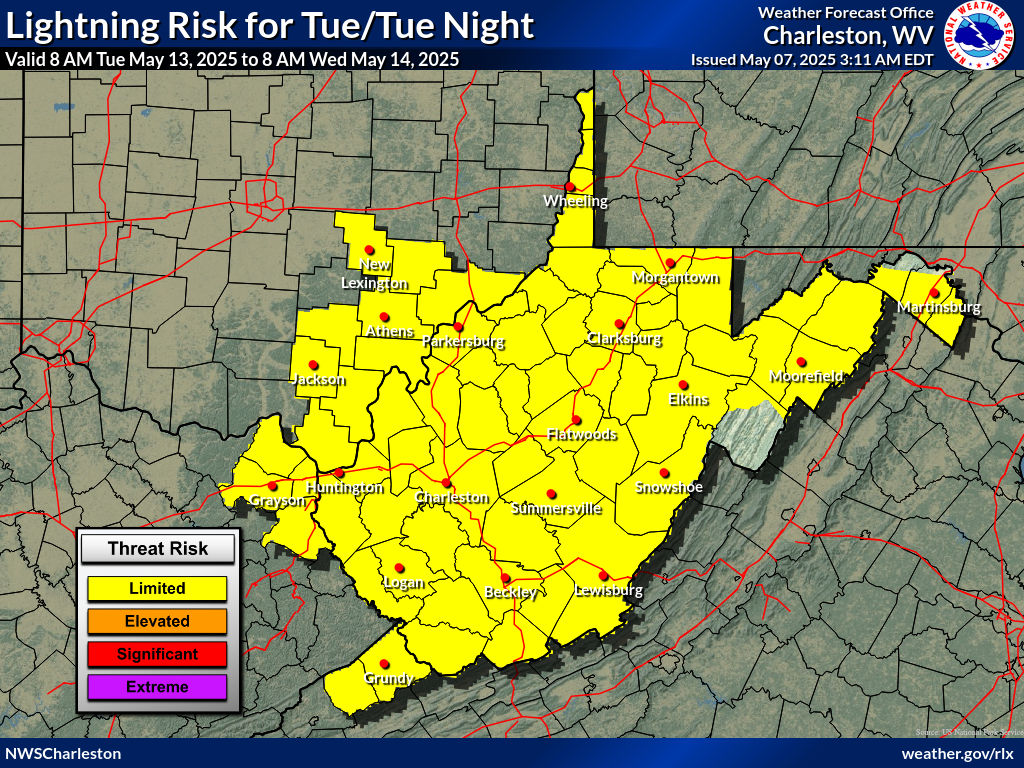
Thunderstorm Threat Briefing
|
|
|
|
|||||||
|
|
|
|
|||||||
|
|
|
|
|||||
| Days 4-7 Thunderstorm Outlooks | |||
 |
 |
 |
 |
 |
 |
 |
 |

 |
Current Watches |
Storm Trend Discussions |
Today's Storm Reports |
Yesterday's Storm Reports |
| SPC Day 1 Thunderstorm Outlook | SPC Day 1 Tornado Outlook | SPC Day 1 Severe Wind Outlook | SPC Day 1 Severe Hail Outlook |
 |
 |
 |
 |
| SPC Day 1 Thunderstorm Outlook Discussion | |||
| SPC Day 2 Thunderstorm Outlook | SPC Day 2 Tornado Outlook | SPC Day 2 Severe Wind Outlook | SPC Day 2 Severe Hail Outlook |
 |
 |
 |
 |
| SPC Day 2 Thunderstorm Outlook Discussion | |||
| SPC Day 3 Thunderstorm Outlook | SPC Day 4-8 Thunderstorm Outlook |
 |
 |
| SPC Day 3 Outlook Narrative | SPC Day 4-8 Outlook Narrative |
Winter Weather Threat Briefing
| 72 Hour Snowfall Forecast | 72 Hour Ice Accumulation Forecast | Winter Storm Severity Index | |
 |
 |
 |
|
| Day 1 Snowfall Forecast | Day 2 Snowfall Forecast | Day 3 Snowfall Forecast |
 |
 |
 |
| 30 Hour Forecast Snow Amounts (6 Hour Periods) | ||||||
| 0 to 6 Hours | 6 to 12 Hours | 12 to 18 Hours | 18 to 24 Hours | 24 to 30 Hours | 30 to 36 Hours | |
 |
 |
 |
 |
 |
 |
|
| Day 1 Ice Accumulation Forecast | Day 2 Ice Accumulation Forecast | Day 3 Ice Accumulation Forecast |
 |
 |
 |
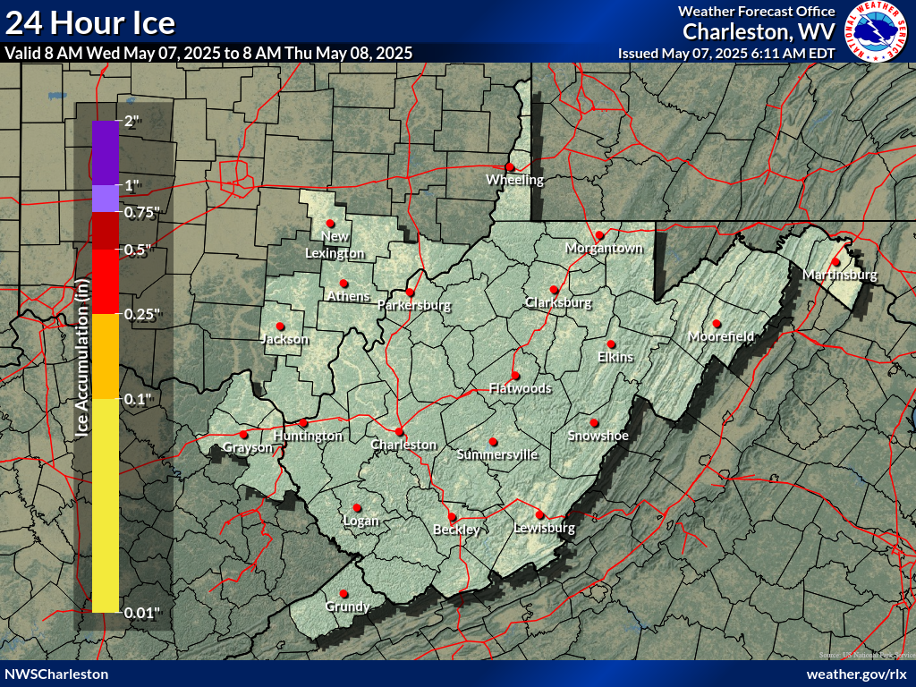
| 30 Hour Forecast Ice Accumulation (6 Hour Periods) | ||||||
| 0 to 6 Hours | 6 to 12 Hours | 12 to 18 Hours | 18 to 24 Hours | 24 to 30 Hours | 30 to 36 Hours | |
 |
 |
 |
 |
 |
 |
|
| Day 1 Snowfall Greater Than 4" | Day 2 Snowfall Greater Than 4" | Day 3 Snowfall Greater Than 4" |
 |
 |
 |
| Day 1 Freezing Rain Greater than 1/4" | Day 2 Freezing Rain Greater than 1/4" | Day 3 Freezing Rain Greater than 1/4" |
 |
 |
 |
| Day 4 Experimental Winter Weather Outlook | Day 5 Experimental Winter Weather Outlook | Day 6 Experimental Winter Weather Outlook | Day 7 Experimental Winter Weather Outlook |
 |
 |
 |
 |
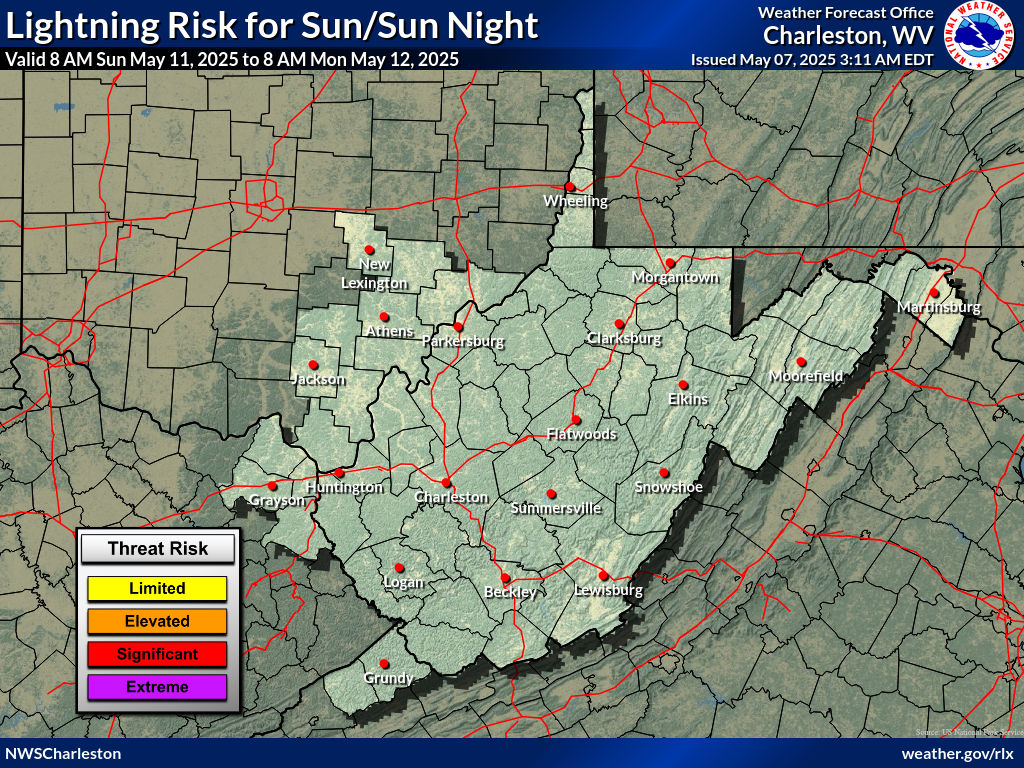
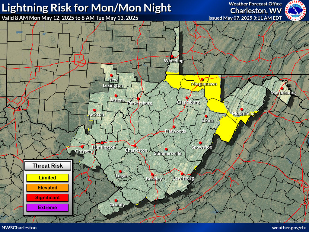
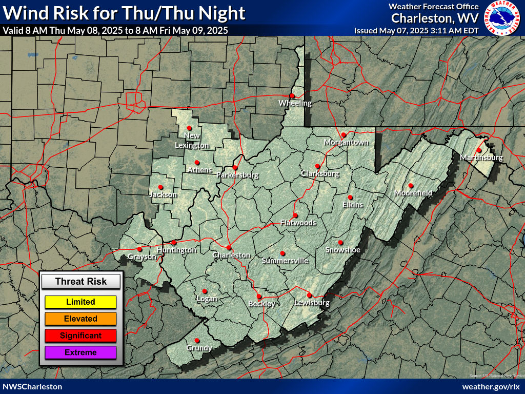
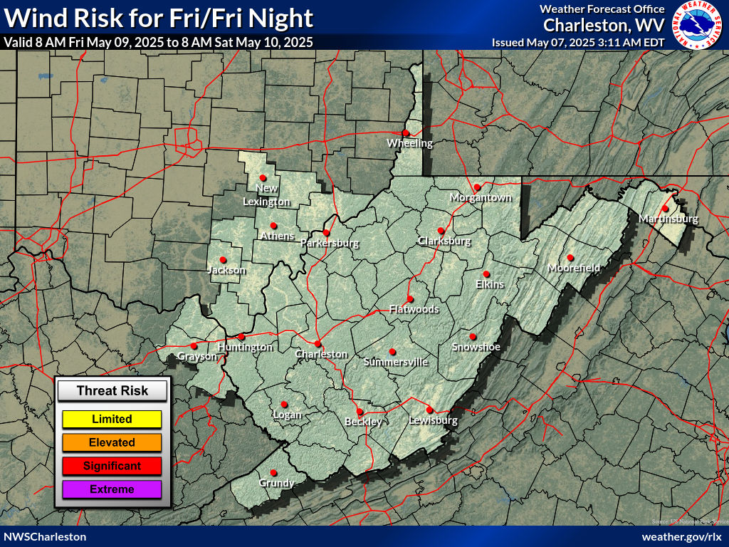
Wind Threat Briefing
|
| Day 1 Wind Risk | Day 2 Wind Risk | Day 3 Wind Risk |
 |
 |
 |
 |
||
| Day 1 Max Wind Gusts | Day 2 Max Wind Gusts | Day 3 Max Wind Gusts |
 |
 |
 |
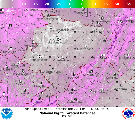
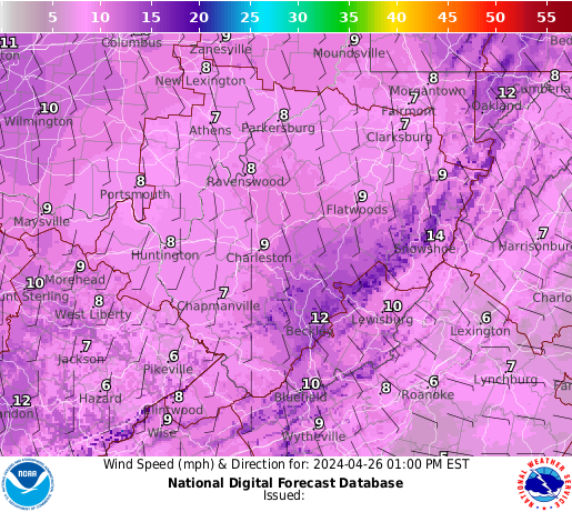
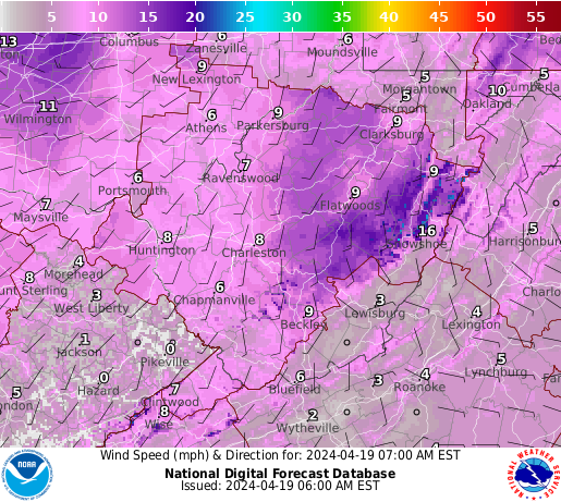
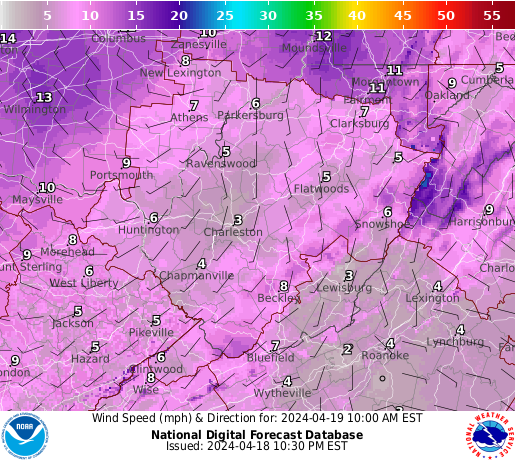
| 3 Hourly Wind Speed & Direction Forecasts |
 |
 |
 |
 |
 |
 |
|
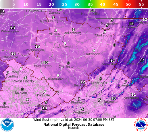
| 3 Hourly Wind Gusts |
 |
 |
 |
 |
 |
 |
|
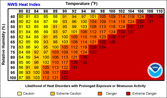
Heat Threat Briefing​
|
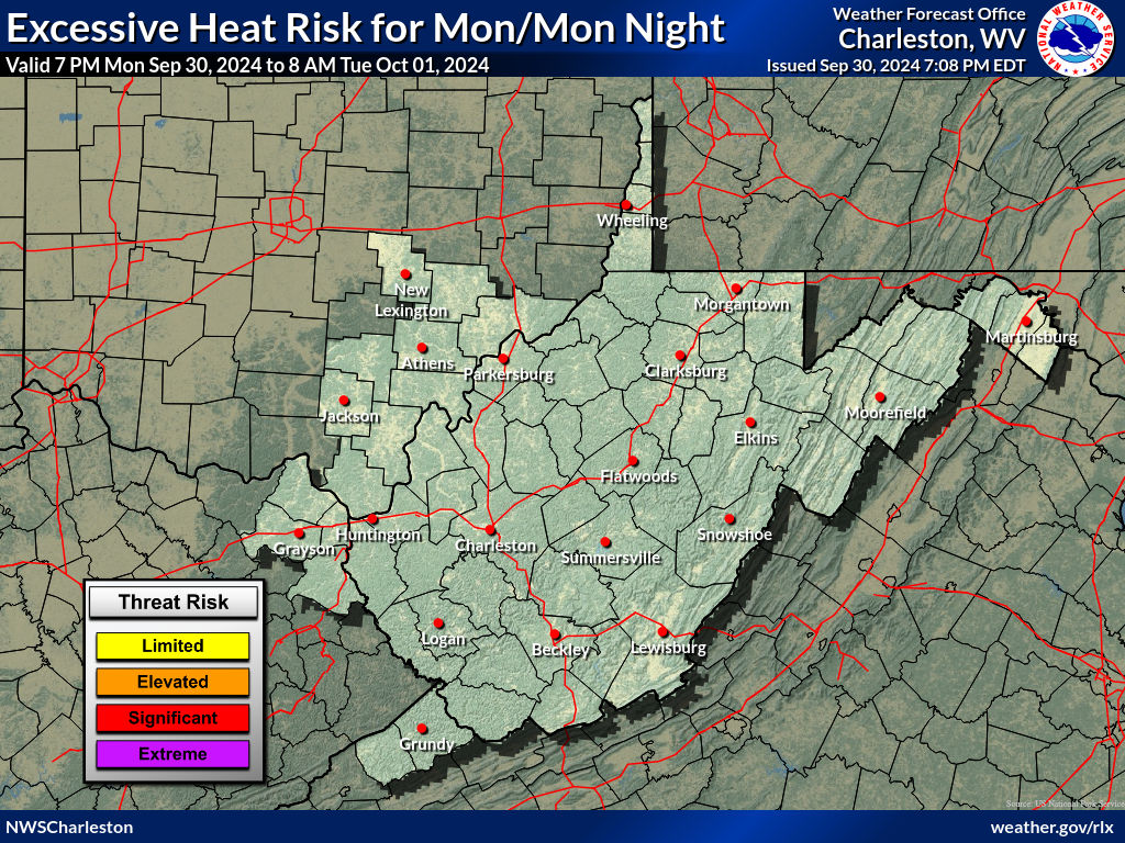
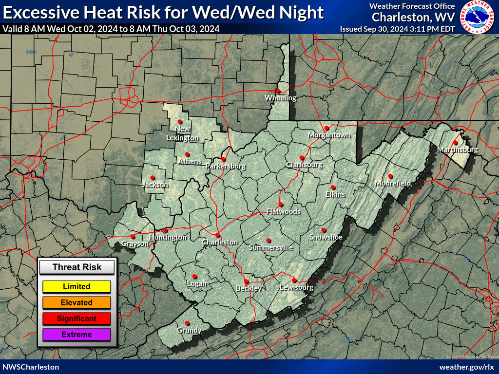
| Day 1 Excessive Heat Risk | Day 2 Excessive Heat Risk | Day 3 Excessive Heat Risk |
 |
 |
 |
 |
||
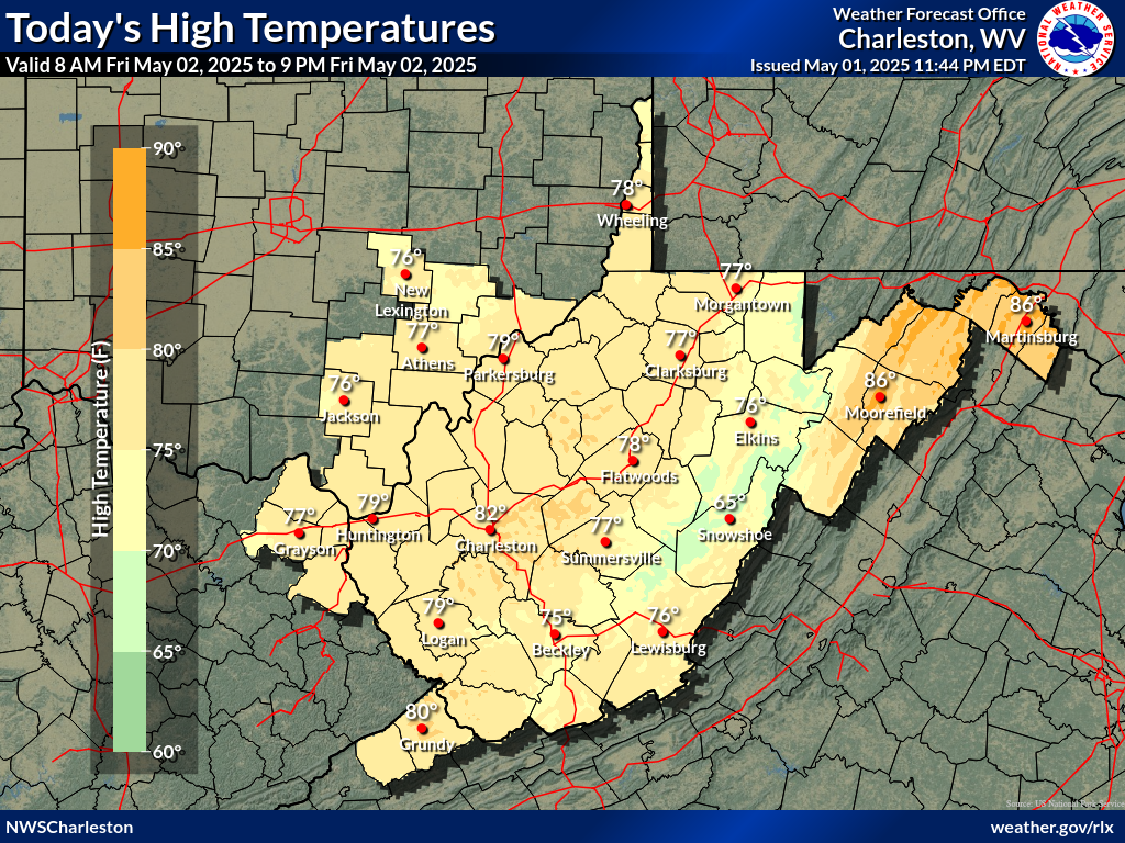
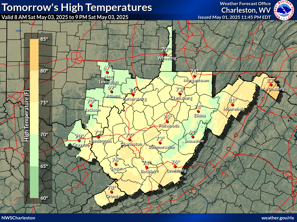
| Day 1 Max Temp | Day 2 Max Temp | Day 3 Max Temp |
 |
 |
 |
| Day 1 Min Temp | Day 2 Min Temp | Day 3 Min Temp |
 |
 |
 |
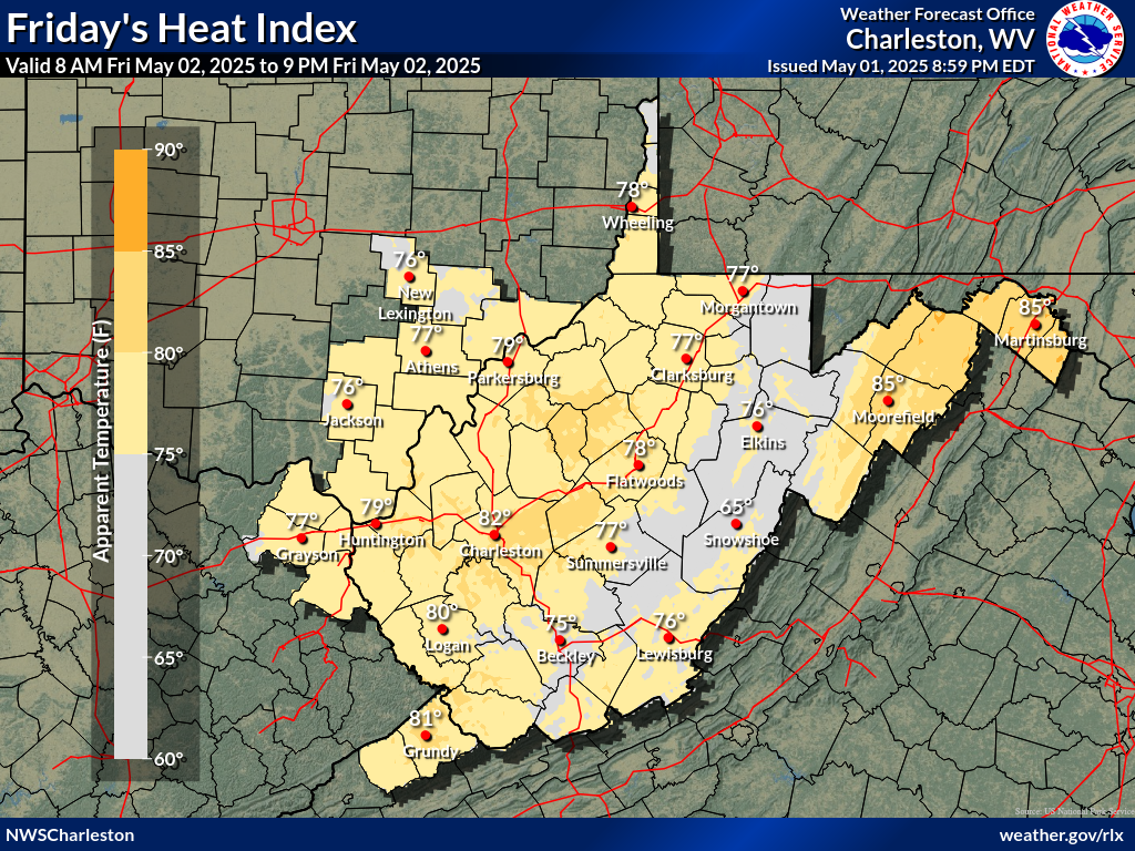
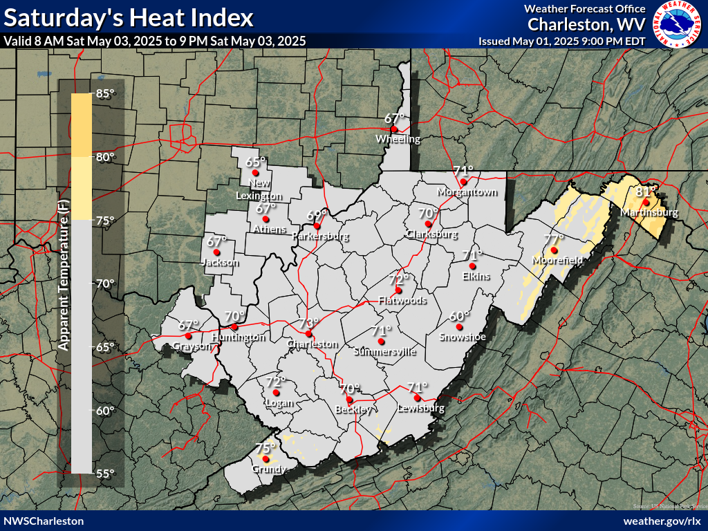
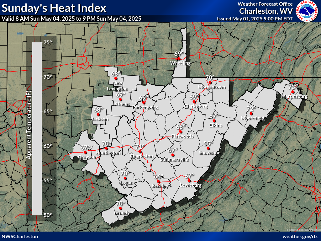
| Day 1 Max Heat Index | Day 2 Max Heat Index | Day 3 Max Heat Index |
 |
 |
 |
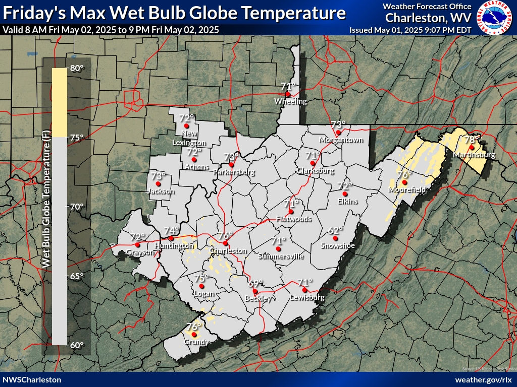
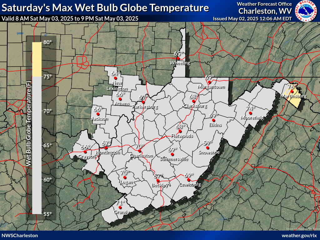
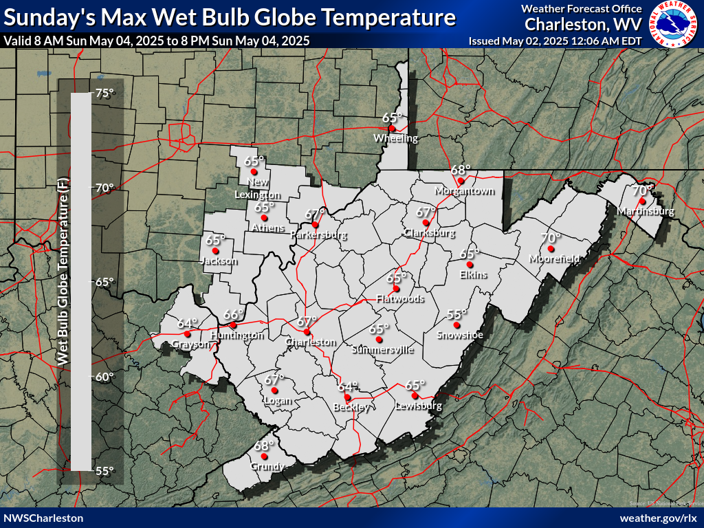
| Day 1 Max WBGT | Day 2 Max WBGT | Day 3 Max WBGT |
 |
 |
 |
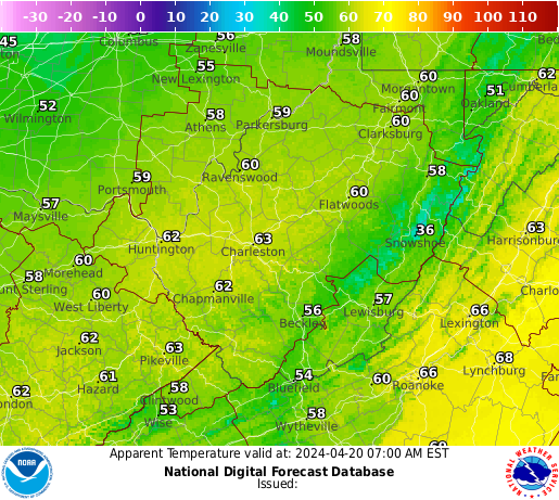
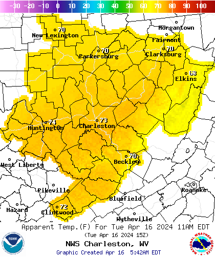
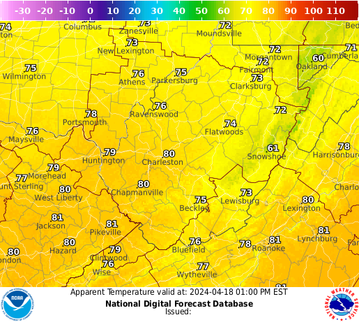
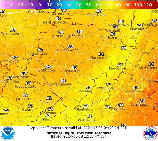
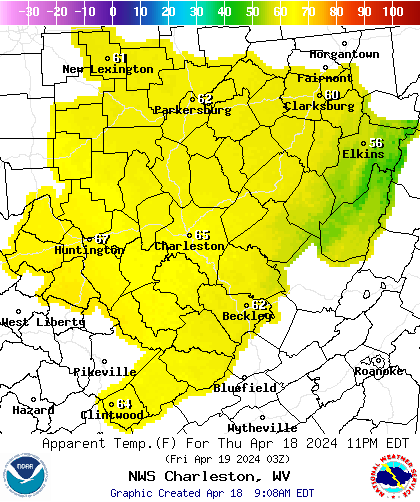
| 3 Hourly Apparent Temperature |
 |
 |
 |
 |
 |
 |
|
 |
 |
Cold Threat Briefing​
|
| Day 1 Excessive Cold Risk | Day 2 Excessive Cold Risk | Day 3 Excessive Cold Risk |
 |
 |
 |
 |
||
| Day 1 Max Temp | Day 2 Max Temp | Day 3 Max Temp |
|
|
|
| Day 1 Min Temp | Day 2 Min Temp | Day 3 Min Temp |
|
|
|
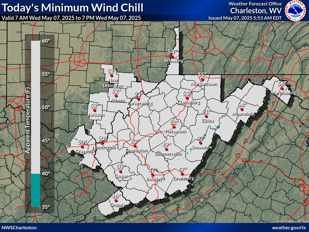
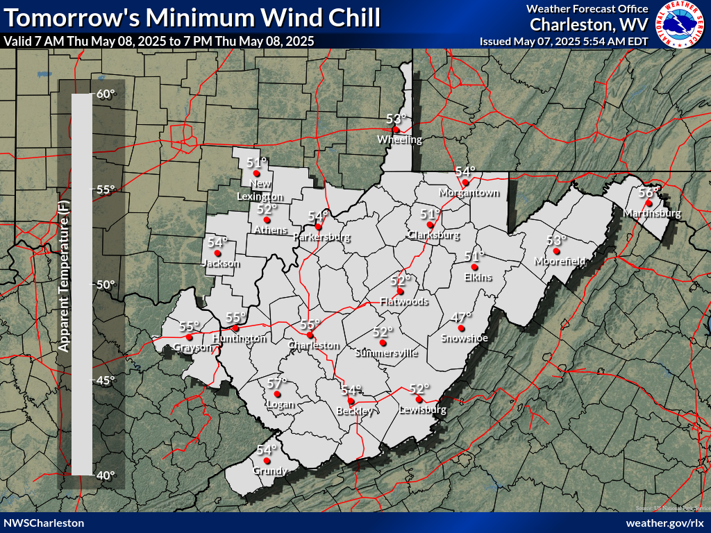
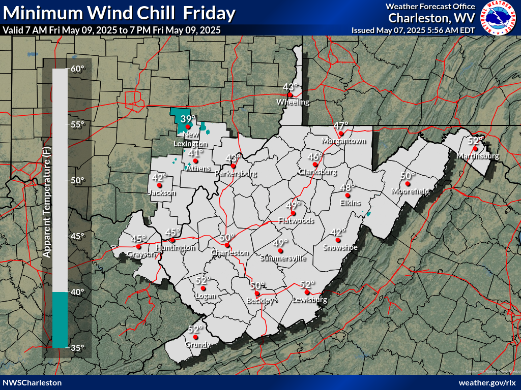
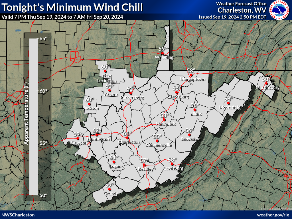
| Day 1 Min Wind Chill | Day 2 Min Wind Chill | Day 3 Min Wind Chill |
 |
 |
 |
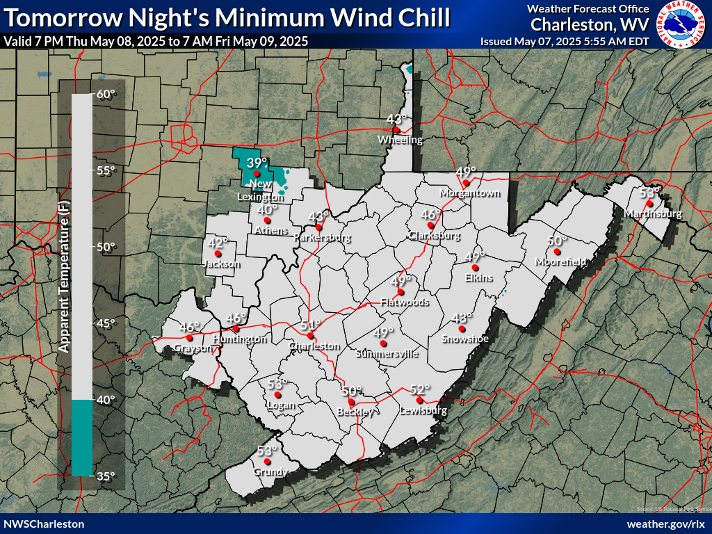
| Night 1 Min Wind Chill | Night 2 Min Wind Chill |
 |
 |
| 3 Hourly Apparent Temperature |
|
|
|
|
|
|
|
 |
 |
Drought and Fire Weather Threat Briefing
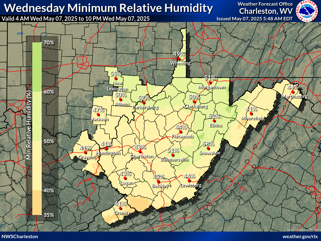
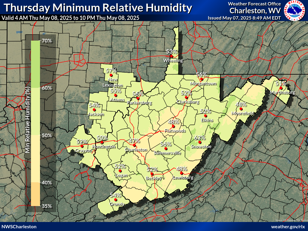
| Today's Minimum Humidity | Tomorrow's Minimum Humidity |
 |
 |
| Today/Tonight Max Wind Gusts | Tomorrow/Tomorrow Night Max Wind Gusts |
|
|
WFAS Observed Fire Danger Rating |
WFAS Forecast Fire Danger Rating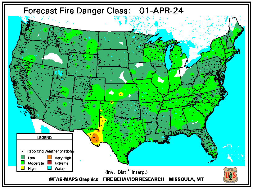 |
| SPC Fire Weather Day 1 Outlook | SPC Fire Weather Day 2 Outlook | SPC Fire Weather Day 3-8 Outlook |
 |
 |
 |
 |
 |
| Seasonal Drought Outlook | NICC Significant Fire Potential Outlook |
 |
 |
Long Range Outlook Briefing
| Days 3-7 Hazards Outlook (WPC) |
 |
| Days 8-14 Hazards Outlook (CPC) | Days 8-14 Risk of Hazardous Temperatures (CPC) | Days 8-14 Risk of Heavy Precipitation (CPC) |
 |
 |
 |
| 6-10 Day Temperature Outlook (CPC) | 6-10 Day Precipitation Outlook (CPC) |
 |
 |
| 8-14 Day Temperature Outlook (CPC) | 8-14 Day Precipitation Outlook (CPC) |
 |
 |
| **Experimental** Week 3-4 Temperature Outlook (CPC) | **Experimental** Week 3-4 Precipitation Outlook (CPC) |
 |
 |
| One Month Temperature Outlook (CPC) | One Month Precipitation Outlook (CPC) |
 |
 |
| Three Month Temperature Outlook (CPC) | Three Month Precipitation Outlook (CPC) |
 |
 |