Prior to every flight, pilots should gather all information vital to the nature of the flight. This site is informational in nature and is designed to assist pilots and aircrews for flight planning and weather familiarization. It may be used in conjunction with other preflight information sources needed to satisfy all the requirements of 14 CFR 91.103 and is not to be considered as a sole source of information to meet all preflight action. Pilots can complete their regulatory-compliant preflight briefing by using other automated resources or from Flight Service at www.1800wxbrief.com or by calling 1-800-WX-BRIEF.
.AVIATION /19Z SATURDAY THROUGH THURSDAY/...
As of 220 PM Saturday...

Morning MVFR stratocumulus had lifted all but opposite ends of
th forecast area, PKB and BKW. It should lift above 3 kft at
PKB in the first hour or two of the forecast but ceilings at BKW
may stay close to 3 kft this afternoon.

Diurnal convection this afternoon will be most prevalent in and
near the mountains. Any thunderstorm can produce MVFR to LIFR
conditions and gusty winds.

Any convection will die down around sunset, but dense fog is
likely to form again overnight. The fog forecast may need to be
adjusted to account for which TAF sites get rain from a shower
or thunderstorm, but some fog or mist is still likely even in
the absence of rain this afternoon and evening at a particular
location.

The fog will lift into IFR stratus and then MVFR stratocu again
Sunday morning, but this process will likely be faster than was
the case today. A VFR day will then ensue, with less afternoon
convection to follow, compared with today.

Light north to variable surface flow this afternoon will become
calm tonight, and then light and variable on Sunday, all beneath
light north flow aloft.

FORECAST CONFIDENCE AND ALTERNATE SCENARIOS THROUGH 18Z SUNDAY...

FORECAST CONFIDENCE: Medium
AVIATION FORECAST CONFIDENCE
| Updated: 224 PM EDT Sat May 18 2024 |
| UTC | 18 | 19 | 20 | 21 | 22 | 23 | 00 | 01 | 02 | 03 | 04 | 05 |
| EDT | 14 | 15 | 16 | 17 | 18 | 19 | 20 | 21 | 22 | 23 | 00 | 01 |
| CRW | H | H | H | H | H | H | H | H | H | H | M | L |
| HTS | M | H | H | H | H | H | H | H | H | H | H | H |
| BKW | M | M | H | M | H | H | H | H | H | H | H | H |
| EKN | M | H | H | H | H | H | H | H | H | M | L | L |
| PKB | M | M | H | H | H | H | H | H | H | H | H | H |
| CKB | H | H | H | H | H | H | H | H | H | H | M | H |
| 1 PM | 2 PM | 3 PM | 4 PM | 5 PM | 6 PM | |
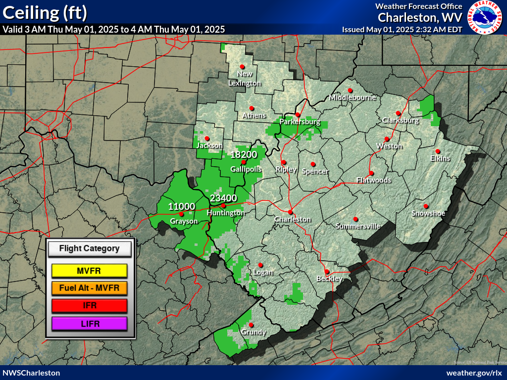 |
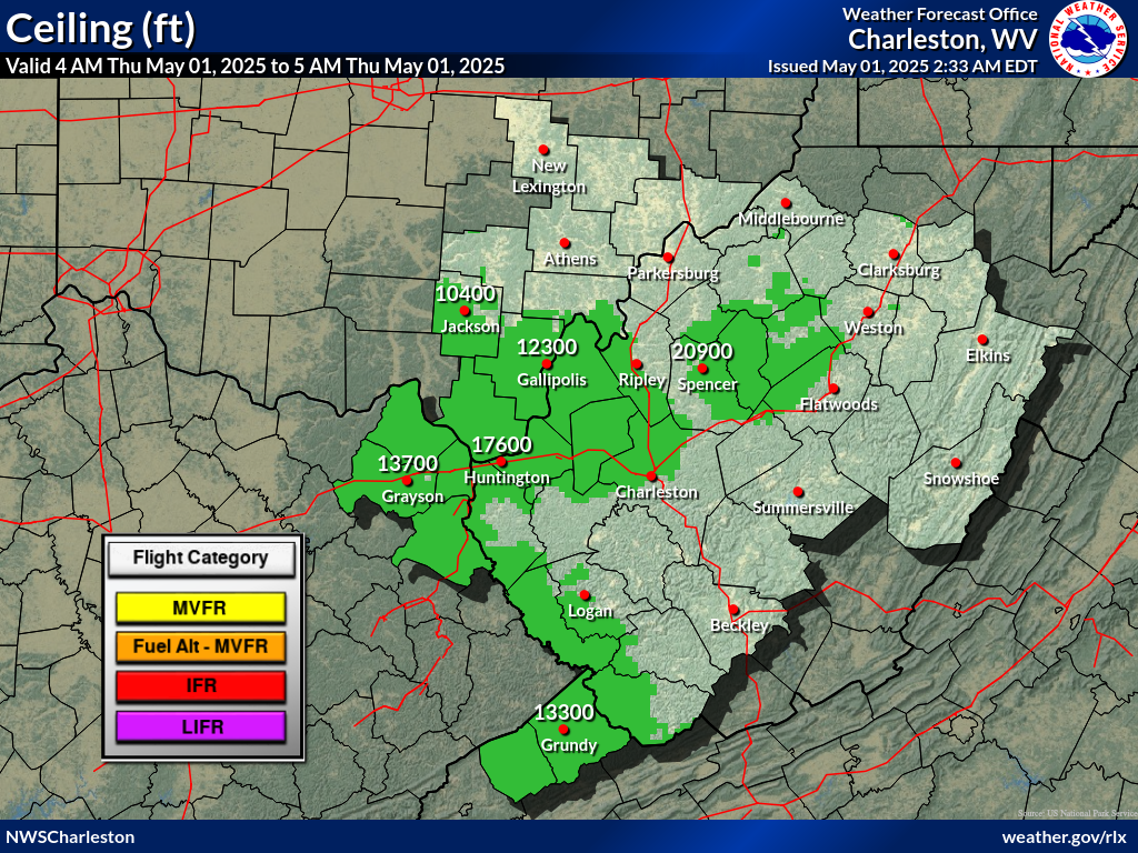 |
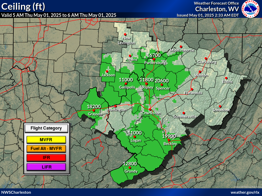 |
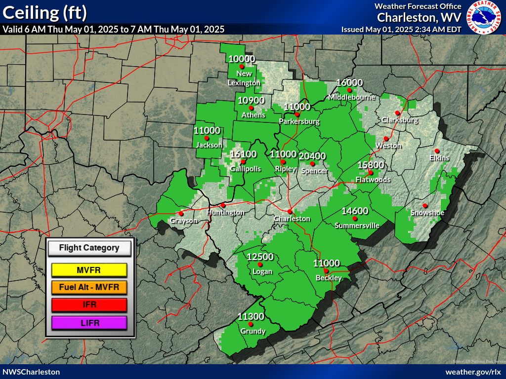 |
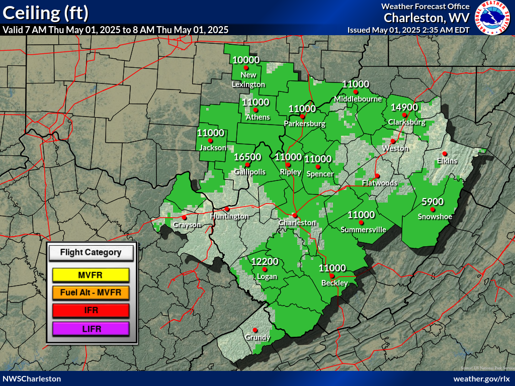 |
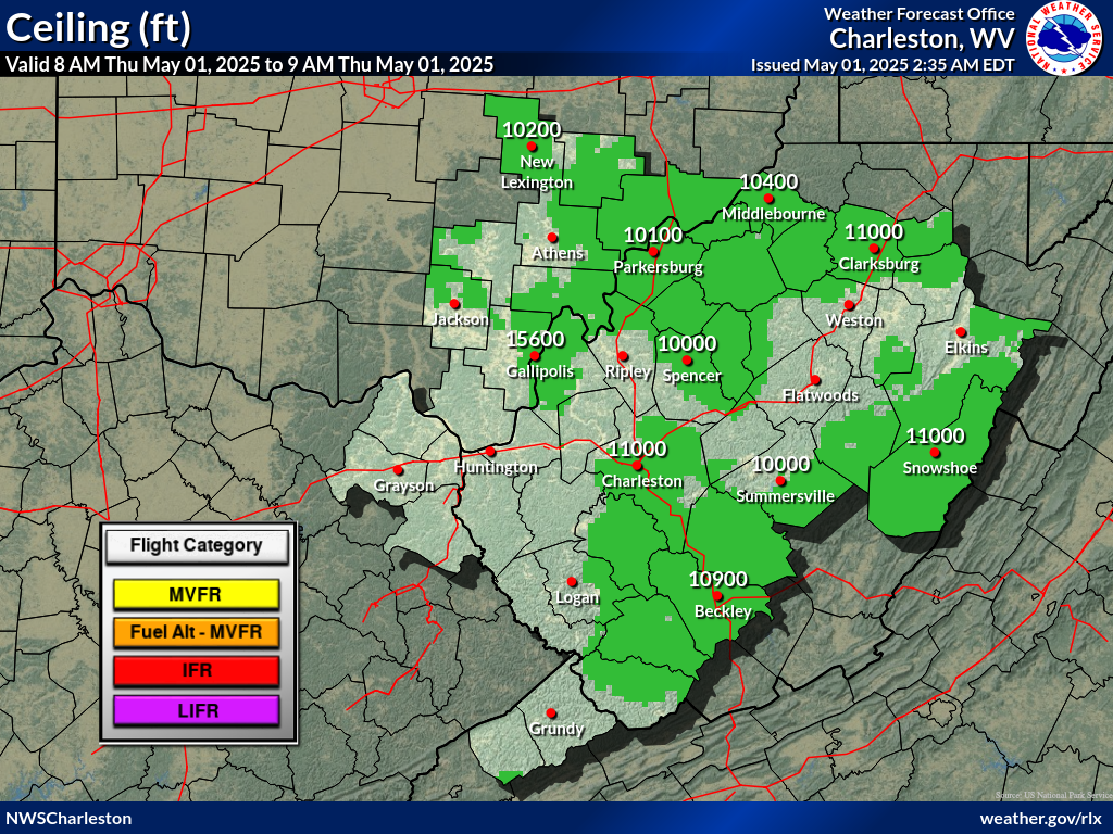 |
 |
| 1 PM | 2 PM | 3 PM | 4 PM | 5 PM | 6 PM | |
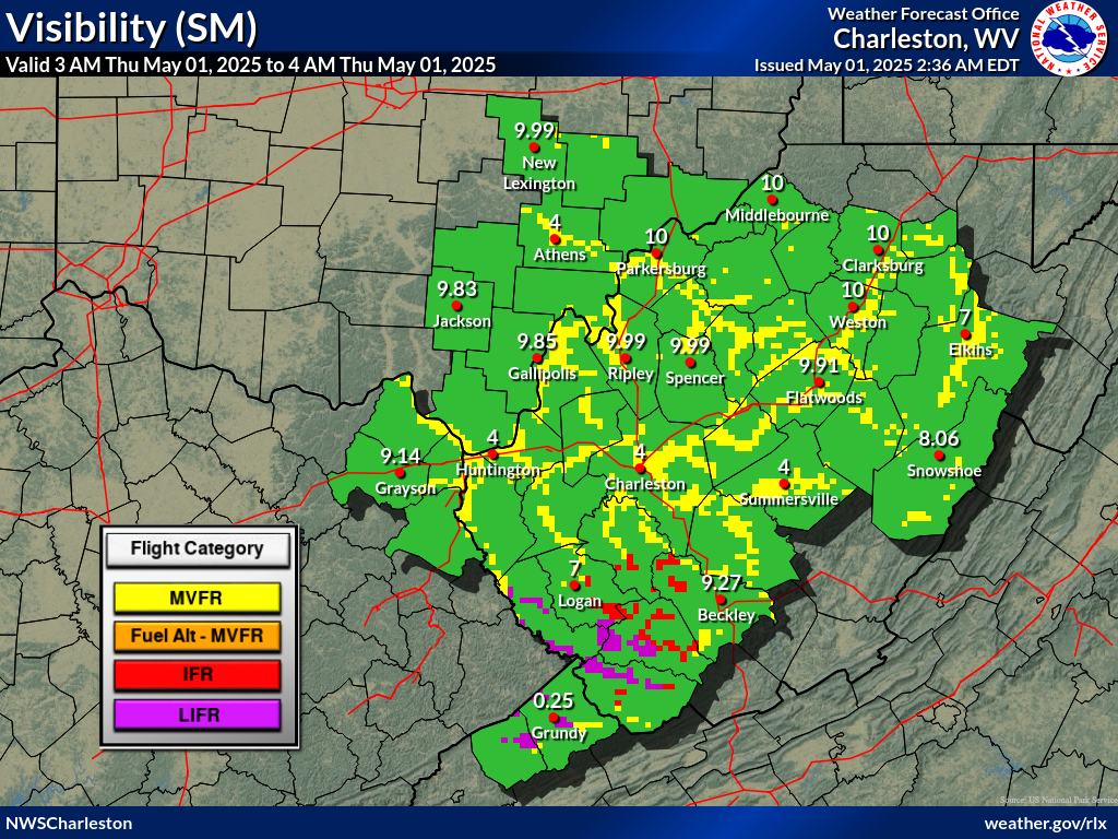 |
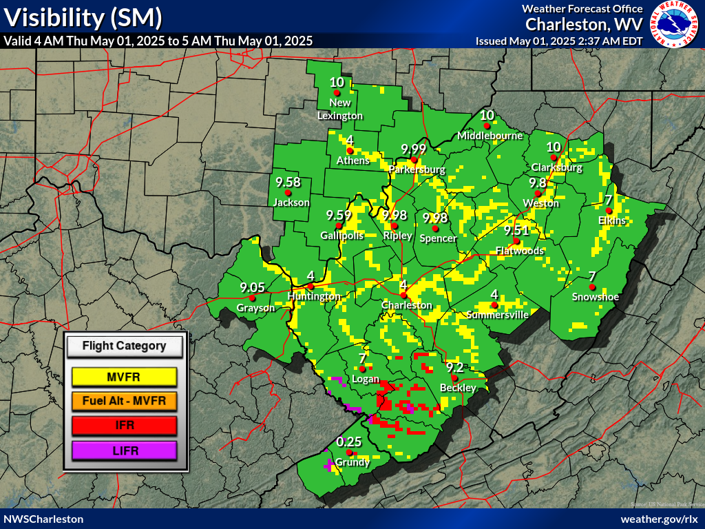 |
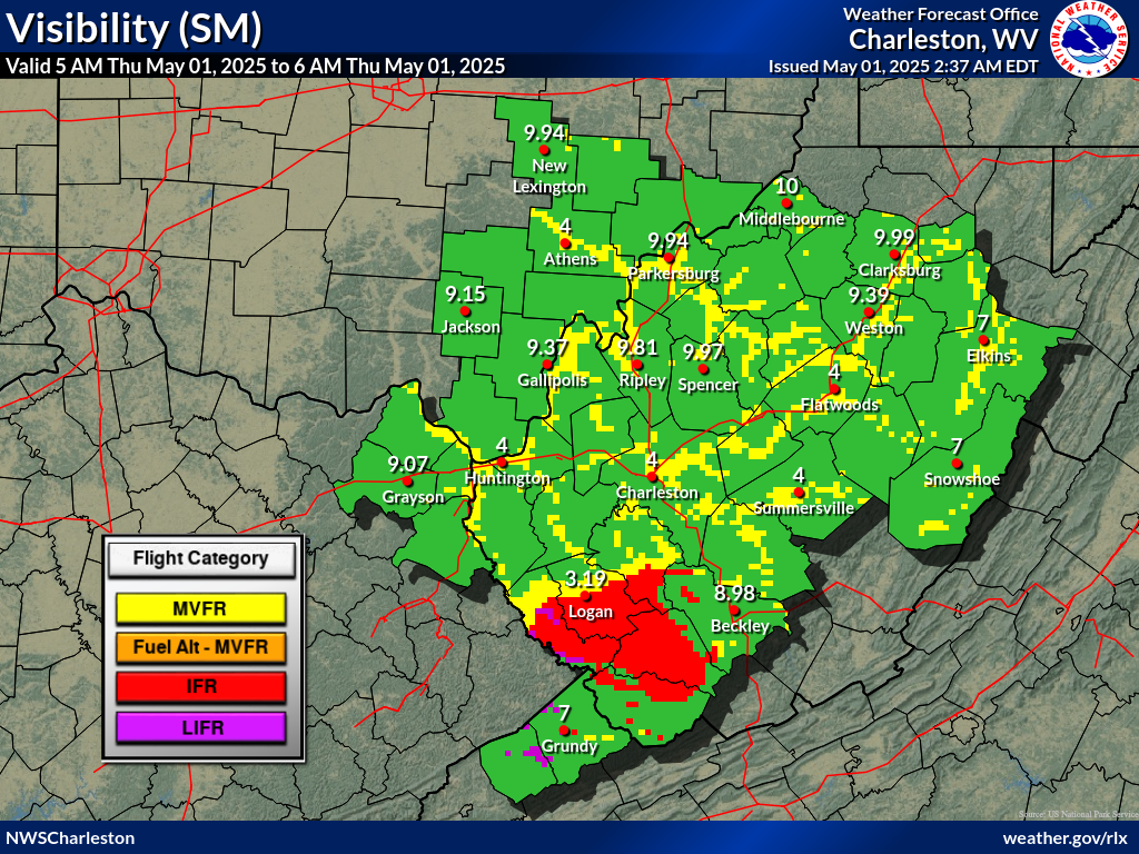 |
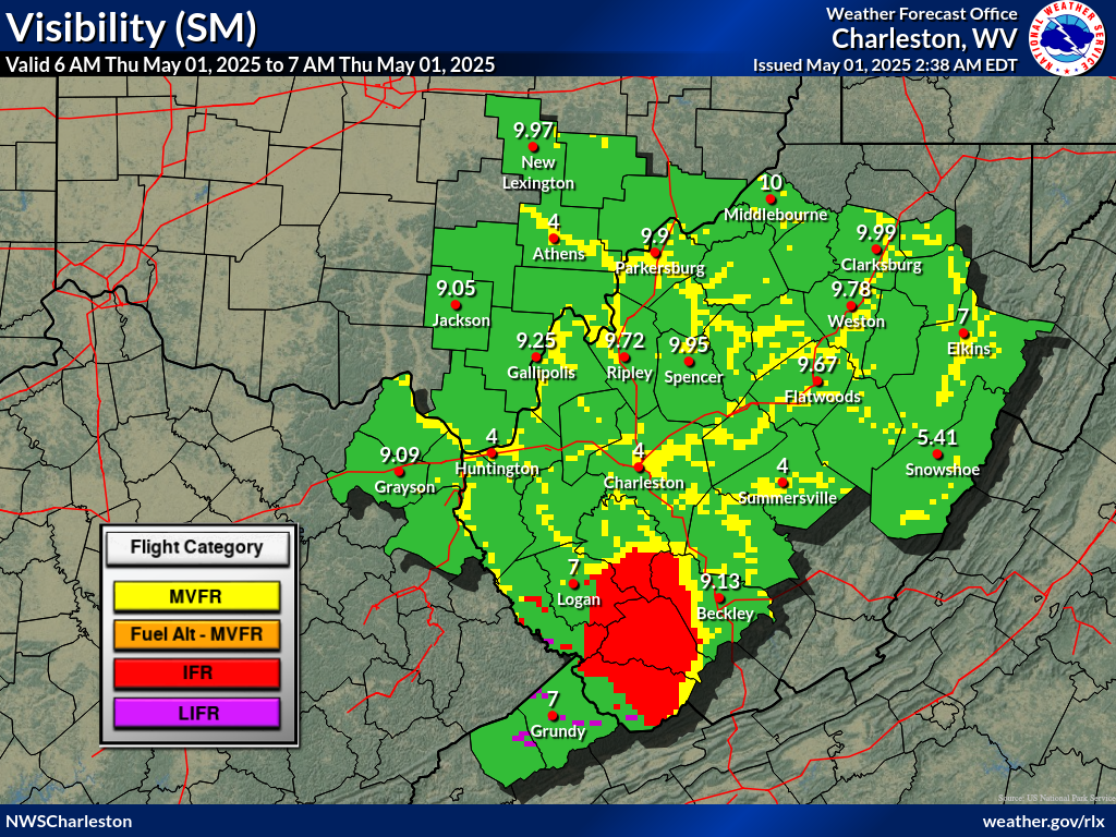 |
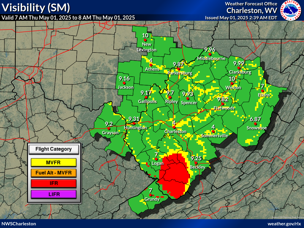 |
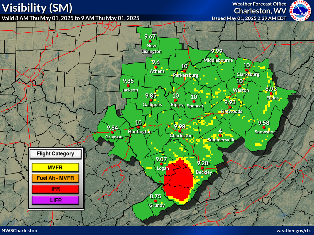 |
 |
![]() Airports with TAFs |
Airports with TAFs | ![]() Airports without TAFs
Airports without TAFs
Additional Local Information |
Regional/National Information |