Winds will continue to increase across the region today, particularly this afternoon as a line of high cloud based showers is likely to move through south-central Arizona. These showers are not expected to bring measurable rainfall, but they should enhance wind gusts this afternoon, potentially up to 35-45 mph for a brief time. Otherwise, expect gusts mostly ranging from 25 to 35 mph. These stronger winds could result in difficult driving conditions and patchy blowing dust. Also, with the dry conditions, fire danger will be elevated, so avoid any activities that could create a spark.


 MRMS Radar Imagery
 Phoenix Radar
 Yuma Radar
 Regional Satellite
 GOES-16 Satellite
.PNG) Weather & Hazards Data Viewer
Weather & Hazards Data Viewer Forecast Discussion
 Fast Page
 Social Media
 Local Graphical Forecast
 Monsoon Tracker
 Fire Weather
 Heat
Heat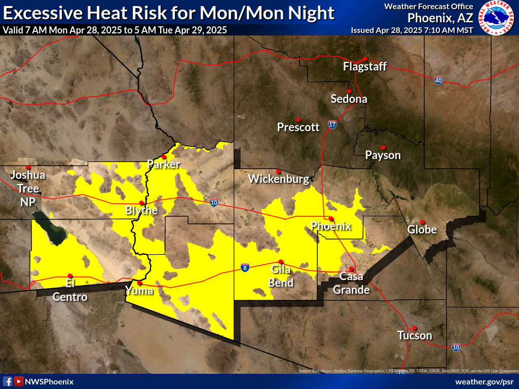 Experimental Graphical HWO
 SPC Outlooks
 Phoenix Rainfall Index
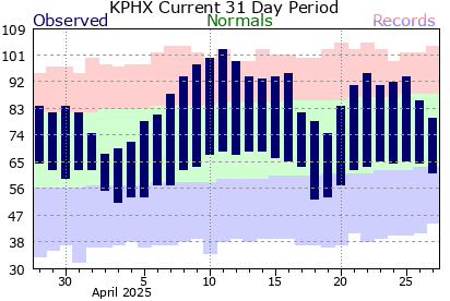 Local Climate Information
 Hi-res KPHX ASOS Data