
Isolated to scattered severe thunderstorms appear possible across portions of the Southeast and Carolinas on Saturday where a Slight Risk (Level 2 of 5) has been issued. A Slight Risk Excessive Rainfall Outlook (Level 2 of 4) has been issued for part of the northern Gulf Coast Saturday due to the threat of flash, urban, and riverine flooding. Read More >
St. Louis, MO
Weather Forecast Office
 24-Hour High Temperature
|
 24-Hour Low Temperature
|
 24-Hour Precipitation
|
 24-Hour Snowfall
|
 Daily Snow Depth
|
|
Five years of archived daily data for our climatology reporting stations can be found by selecting Preliminary Climatology Data (CF6) on our climate page. Daily Records, Observations, and Normals for our primary climatology reporting stations can be found on our climate graphs page. These data are preliminary and have not undergone final quality control by the National Climatic Data Center (NCDC). Therefore, these data are subject to revision. Final and certified climate data can be accessed at the NCDC - https://www.ncdc.noaa.gov. |
FORECAST
Forecaster's Discussion
Local area
GIS Forecast Maps
Activity Planner
Aviation Weather
Fire Weather
Marine Weather
Severe Weather
Winter Weather
Hurricane Center
FAA Center Weather
User Defined Area
US Dept of Commerce
National Oceanic and Atmospheric Administration
National Weather Service
St. Louis, MO
12 Missouri Research Park Drive
St. Charles, MO 63304-5685
636-441-8467
Comments? Questions? Please Contact Us.


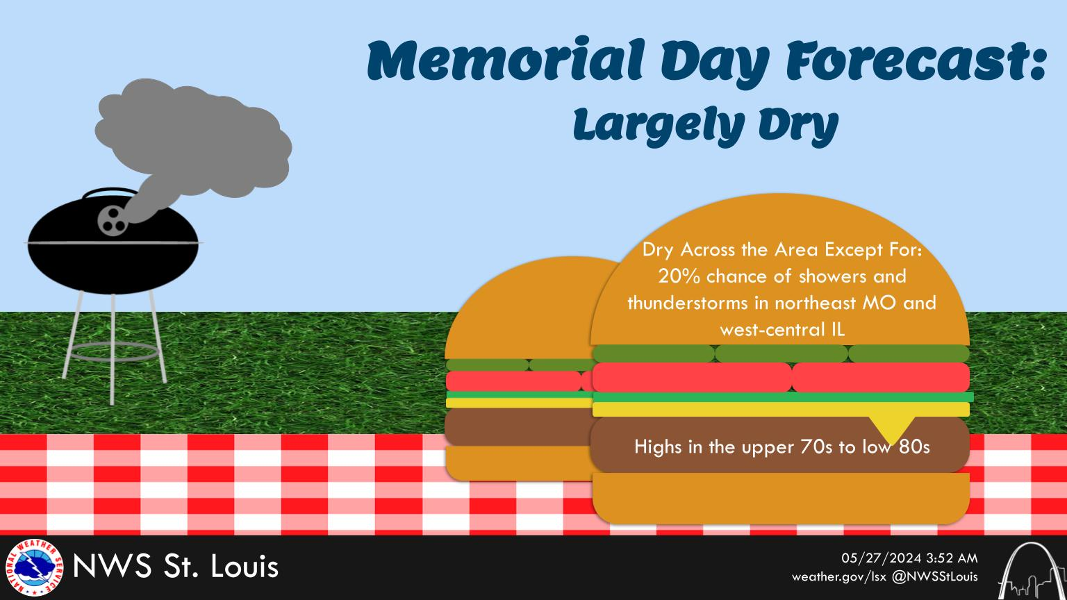 Weather Story
 Weather Map
 Local Radar