National Weather Service United States Department of Commerce
Click a location below for detailed forecast.

Last Map Update: Sat, May 18, 2024 at 10:42:18 pm CDT

Dangerous heat is on the way. We will see an increased risk of heat-related impacts across much of the region next week as heat indices climb into the 110-120° range. Be sure to stay cool, drink plenty of water, and take frequent breaks if you are spending time outside!
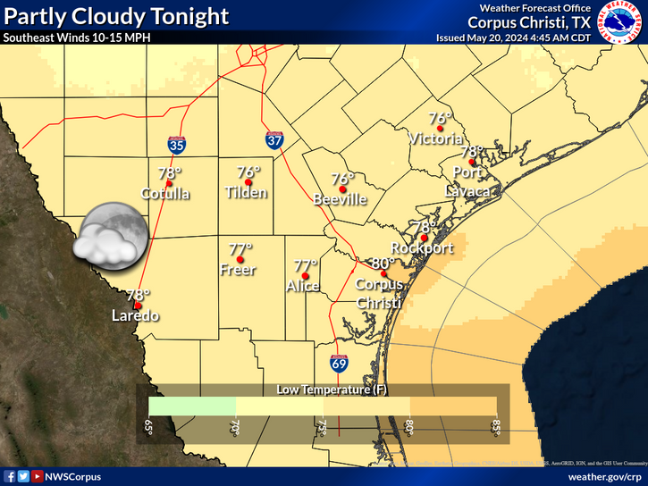
Partly cloudy tonight with lows the 70s. Fog is possible toward morning, mainly in the Victoria Crossroads, and the Coastal Plains.
The heat will continue to build as we enter next week with heat index values around 110-114°F by Tuesday. This will likely continue through the end of the work week leading to heat stress conditions. This also may warrant a Excessive Heat Warning at some point which will be closely monitored.

 
Hourly Weather Roundup ( )
Location Sky/Weather Temp Dewpt RH Wind Baro Remarks
Alice
N/A
N/A
N/A
N/A
N/A
N/A
N/A
Beeville
N/A
N/A
N/A
N/A
N/A
N/A
N/A
Corpus Christi
N/A
N/A
N/A
N/A
N/A
N/A
N/A
Corpus Christi NAS
N/A
N/A
N/A
N/A
N/A
N/A
N/A
Cotulla
N/A
N/A
N/A
N/A
N/A
N/A
N/A
Kingsville NAS
N/A
N/A
N/A
N/A
N/A
N/A
N/A
Laredo
N/A
N/A
N/A
N/A
N/A
N/A
N/A
Port Lavaca
N/A
N/A
N/A
N/A
N/A
N/A
N/A
Rockport
N/A
N/A
N/A
N/A
N/A
N/A
N/A
Victoria
N/A
N/A
N/A
N/A
N/A
N/A
N/A
Note: "N/A" or "MISG" will be displayed if values are not available. In the LOCATION column, click on links for a list of recent observations at sites of interest. In the WIND column, VRB is "variable" and G is "gust". Wind speeds are in MPH. In the BARO (pressure) column, values are in inches. In the REMARKS column, HX is "heat index", WCI is "wind chill index", and VSB is "visibility" (if shown).
 
Text Product Selector
Video Briefing Weather Outlook Fcst Discussion Tropical Marine Tides
Rivers and Lakes Daily Rainfall Drought Fire Observations Satellite

Hourly Wx Graph Graphical Fcst Aviation Climate Past Events Hurricane Guide